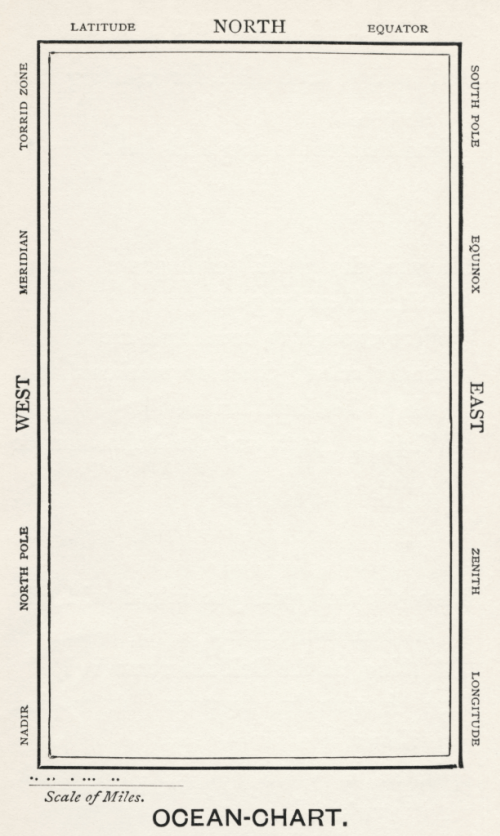
 The old adage less is more is a mantra of map design. While adding detail to show complexity is important, particularly in thematic or statistical cartography, it’s often possible to achieve it through a minimalist approach. For topographic mapping, the white spaces no longer suggest a lack of knowledge that needs filling with strange mythical creatures, but a graphical brevity. Being overly ornate detracts from the message of a map and beautiful, aesthetically pleasing maps are often those that appear quite stark at first glance. This map is possibly the most stark of the lot…a humorous take on large scale mapping at a scale of 1:1 accompanying the famous Lewis Carroll nonsense poem The Hunting of the Snark (An Agony in 8 Fits).
The plot of the poem is of ten crew on a tall ship hunting the Snark yet it’s been interpreted to have many meanings. The poem was illustrated by Henry Holliday who also drafted the Ocean Chart map to accompanycomments in the poem itself that can be easily interpreted as a commentary on the problems of maps and map interpretation:
He had bought a large map representing the sea,
Without the least vestige of land:
And the crew were much pleased when they found it to be
A map they could all understand.
“What’s the good of Mercator’s North Poles and Equators,
Tropics, Zones, and Meridian Lines?”
So the Bellman would cry: and the crew would reply
“They are merely conventional signs!
“Other maps are such shapes, with their islands and capes!
But we’ve got our brave Captain to thank:
(So the crew would protest) “that he’s bought us the best—
A perfect and absolute blank!”
The poem alludes to problems of interpreting complex maps and that the poor crew, who lacked the ability to read a map were delighted to see that the ocean chart, being blank, was perfectly understandable and represented the vast emptiness of the ocean perfectly. That said, the surrounding random map and associated terms are haphazardly arranged to cause maximum confusion, regardless of which orientation in which the map is held.
It’s difficult to argue with the accuracy and clarity of the map. More seriously, it reminds us of the need for accuracy, meeting our user’s abilities in interpretation, not getting overly caught up in convention when a more appropriate approach may be useful, and also the need to use white space wisely.

