
Art and cartography can evolve in all manner of strange circumstances. Many cartographers will try and imbue their work with an artistic element. Many artists use cartographic works to create a piece of art. This example belongs to the latter category though in some respects it bridges the two.
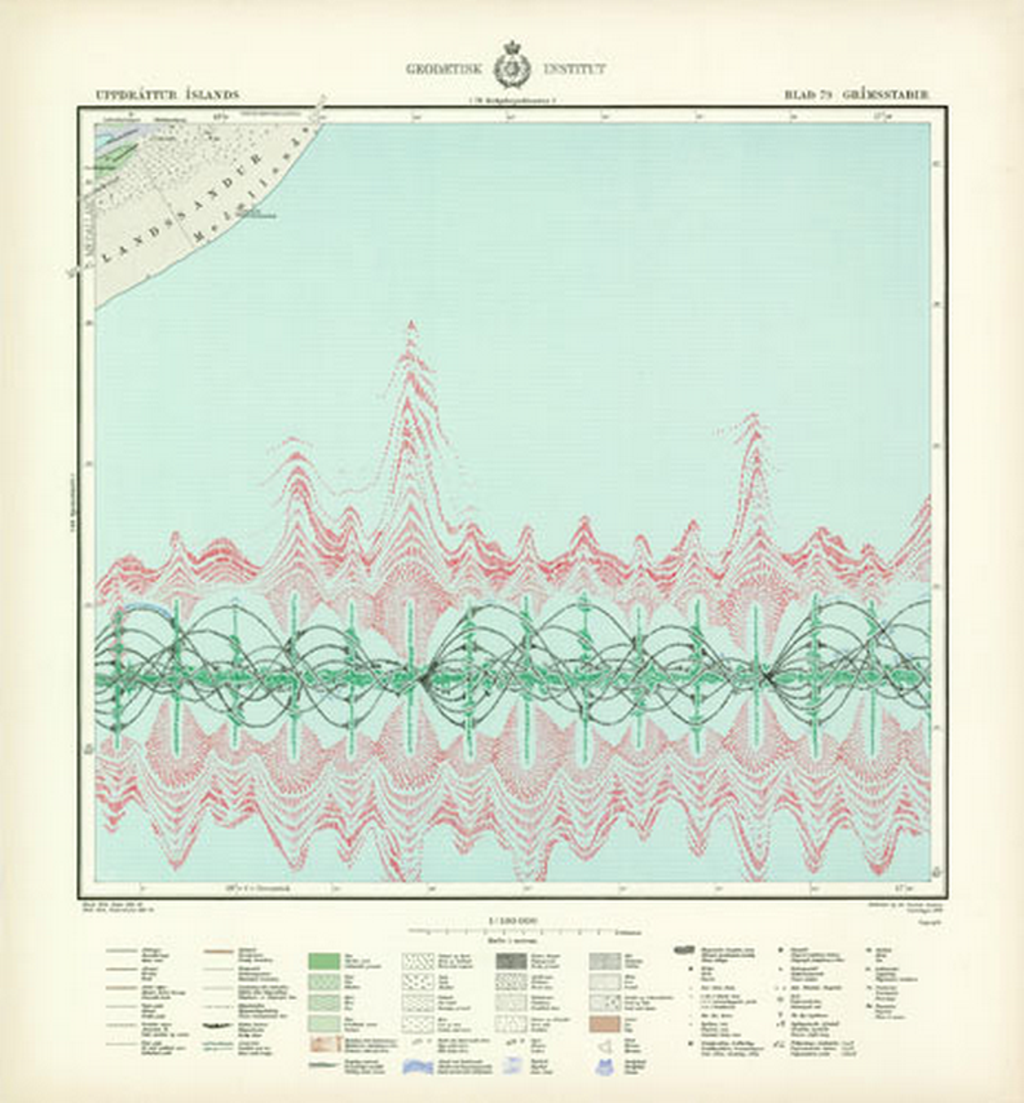
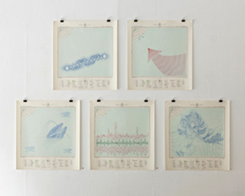
Torgeir Husevaag stumbled upon a series of old topographic maps during a stay in Iceland and bought them with an idea to make something of them. The map sheets were interesting because very little of the printed area had any land. They were predominantly sea and typical of a printed sheet system that inevitably leaves some sheets bereft of much detail.
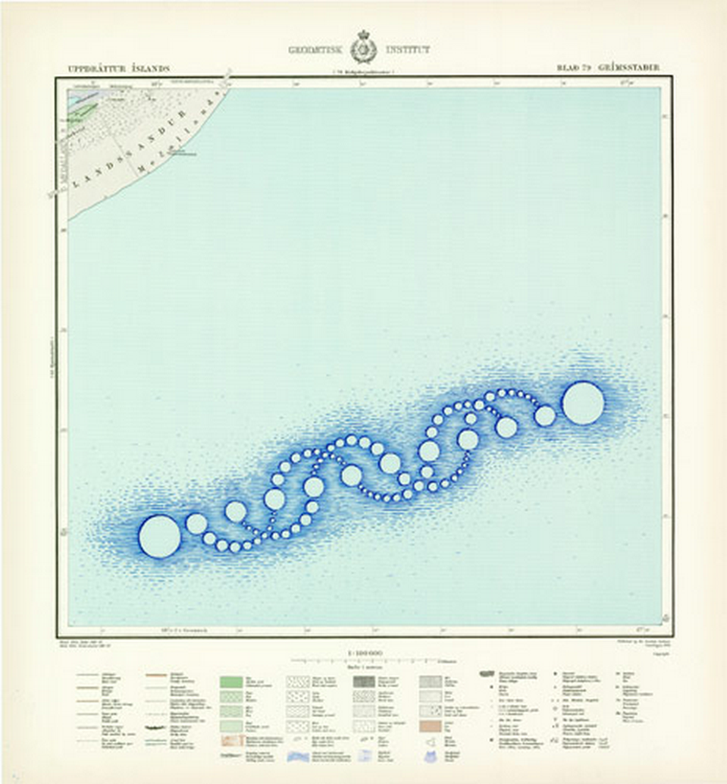
Husevaag’s artistic approach looked at the vast expanse of nothingness and attempted to fill in the gaps with invented phenomena. This, indeed, was an attempt to mirror the perpetual cartographic habit of filling gaps in maps with something, anything. He added a number of different features by drawing on the maps to show a representation of whale song using a sonar pulse, the juxtaposition of crop circles represented in blue in the sea, a pair of mating whales, and an impression of Iceland’s largest mountain depicted as contours in the ocean.
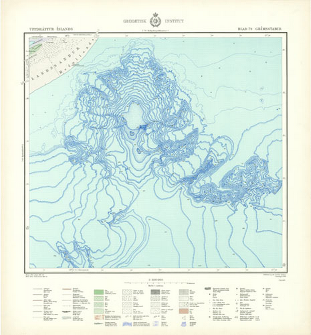
This MapCarte is purely art but draws inspiration from past cartographies to generate new images and uses for the empty spaces on maps.
