
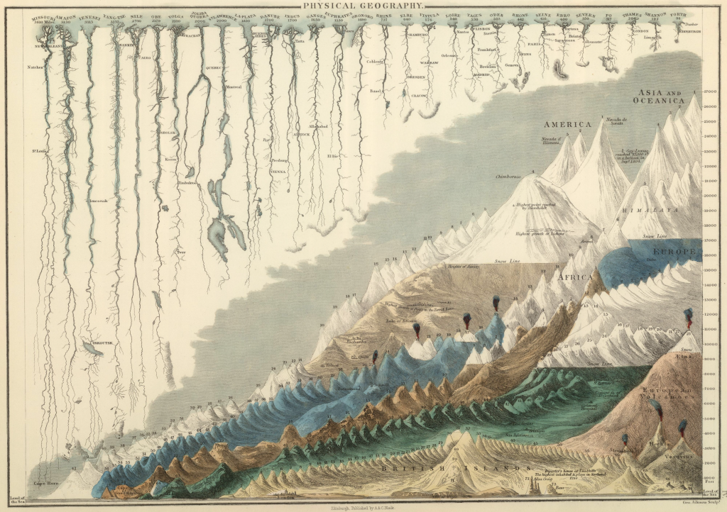
 An atlas map measuring 27cm by 38cm, the depiction of the world’s major mountains and rivers in this way has become a common representation since its publication in the mid 1800s. The map is more of an illustration, being hand drawn and applying a heavy dose of abstraction in order to portray nearly 30 rivers and over 250 mountains.
Rivers are straightened and mountains given a relatively uniform appearance but the clarity that comes from being able to compare on a single page is the key to the success of this map. Immediately we can see the relative height of mountains or length of rivers. We can measure against a scale on the right margin and the map also presents features grouped by continent.
There are some very nice touches such as the spewing volcanoes, the location of some towns and cities and even a small elevation of famous buildings in London for scale across the foot of the page. Here, perhaps is the forerunner of the modern information graphic (infographic) yet at its core it remains a map since it clearly maps out the geography of these physical features.
A zoomable hi resolution version can be viewed on the David Rumsey map collection site here.
