
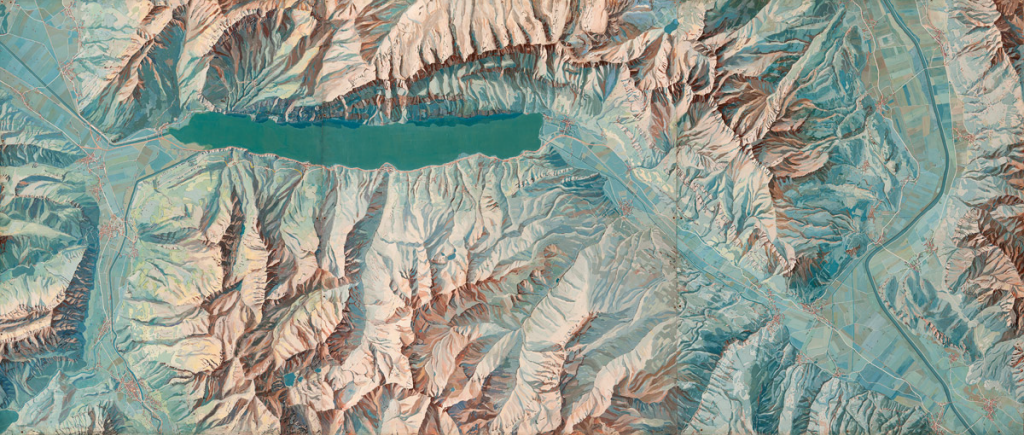
 This original image measures 9.6m in width and illustrates he area around Walensee at 1:10,000. Created by Eduard Imhof, the work appeared in his classic text Cartographic Relief Representation which had a single purpose in teaching the means by which to represent relief in maps. This is a painting in gouache that Imhof used to show a plan view portrayal as naturally as possible.
Imhof employed the techniques of a landscape painter. All linear elements that might be produced using woodcuts, etchings, engraving or lithography are removed since they are abstract and do not appear in a natural landscape. No aerial photographs or existing maps were used as underlay. The result is a beautiful, aesthetically pleasing impressionistic painting yet one that is highly accurate.
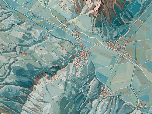
As Imhof himself explained “In detail, the interplay of surface colour, vegetation colour, light and shadow, of reflections and aerial perspective are shown. According to their location and the basic tint of the ground or ground cover, the shadow tones are India red, brown, grey, blue or deep green. Contrast effects also play their part. Even shadows are often lightened and varied in colour by reflected light, but cast shadows are strongly deepened. A slope bathed in sunlight appears bright ochre or yellowish red, but in shadow it is a deep red violet. In a large scale portrayal such as this, with its simple and powerful relief forms, the coloured mosaic of ground cover influences the colour of the depth effects but does not destroy them”
The virtual library of Eduard Imhof is here.

Pingback: color « hunt+gather studio blog
Pingback: MapCarte 285/365: Lake Wakatipu by Simon Bardsley, 2014 | Commission on Map Design