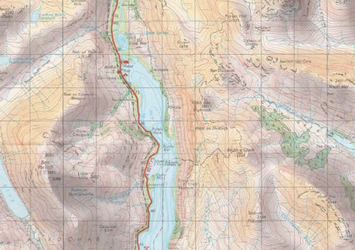
By the middle of the twentieth century, developments in surveying, photogrammetry, cartographic reproduction and printing technology had modernised medium scale topographic mapping. Ordnance Survey’s popular One-inch to the mile series provided the foundation for various tourist editions that demonstrated the mapping technology using the dramatic geography of the united kingdom’s most scenic and varied landscapes. The example here is from the Loch Lomond and The Trossachs Tourist Map (1:63,360) and illustrates the accurate contouring that characterised the work but also the way in which the design effectively captures both high and low relief areas.
The maps could have merely illustrated contours for representing relief but they added purple/grey hill shading for the shaded slopes and a light yellow-buff for the lit slopes that gave character to the slopes and which mimic, to some extent, the purples often seen on heather-clad slopes. Pale green tints are applied to lowland areas. This map would not have worked as well with Imhof-inspired blue hues better suited to mountainous areas and demonstrates that the geography of an area should in part lead the map-maker to make choices in depiction that relate to specifics and not just cartographic principles. There’s a subtlety in the colour choice that works particularly well on this map.


Pingback: MapCarte 295/365: 7.5 minute Quadrangle sheets by USGS, 1945-1992 | Commission on Map Design