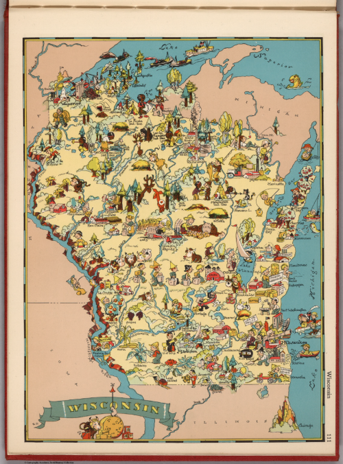
A charming pictorial atlas. Ruth Taylor’s maps present a hugely entertaining picture of the United States in cartoon form. Each state and outlying territories gets its own page and original drawing which provides a snapshot of the social and geographical setting of the area of the time. The landscape is populated by people going about their daily lives; the major sights and scenery are illustrated as well as crops and indigenous flora and fauna. Each map shows the main topographical features and geography of the area in a way that no reference or thematic map can achieve. Here, the map itself has character as well as allowing you to glean a basic understanding of what is where.
As with most cartoon-style atlases and maps, the images are stereotypical and sometimes jarring in a modern context. The map of Tennessee, for instance, shows a Ku Klux Klan member complete with robe, hood and pistol. However, such maps often reveal what was culturally or socially of note at the time of their creation and illustrations were often included precisely to be provocative or even satirical in style.
Pictorial maps genuinely combine cartography with art and are often sought after and collectible. Consequently, many are disassembled as individually the maps can command a higher value than the complete book.


