Although strictly speaking MapCarte is about showcasing great examples of map design, many maps from after the mid-late twentieth century and onwards owe much to one man’s detailed exposition of cartographic symbology. Jacques Bertin’s ‘Semiology of Graphics‘ was first published in French in 1967 and subsequently translated into English and republished. Bertin’s classic ‘Semiology of Graphics’. It is a classic of information design as it leaves almost no stone unturned in presenting the principles of graphical communication.
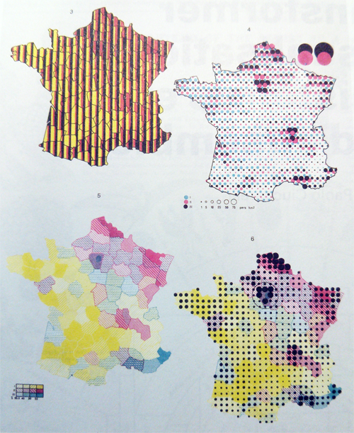
Bertin developed many standard rules which have become de facto syntax and grammar of the cartographic language. He didn’t make many maps outside of his book but the second part contains over 1,000 maps and illustrations that demonstrate the clarity of the principles at work Here, we see a set of maps of France showing how one can manipulate some basic graphical marks to present multidimensional (multivariate) data. This, of course, is one of the challenges for any thematic map and usually the answer is to eliminate detail and present different variables using separate maps. However, with careful choice of symbology it’s possible to combine symbols to represent multiple pieces of information in a way that doesn’t clutter the image or cause the map reader to be overwhelmed.
A classic text with many perfectly framed maps and illustrations that showcase the graphical language of cartography.

