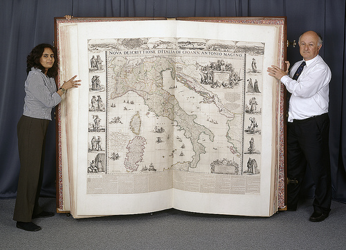
Until recently, the Klencke Atlas was renowned as being the largest atlas in the world (a title now taken by Millenium House’s Platinum Earth atlas) but size alone would not necessarily get the work into a list of great maps. The atlas was presented to Charles II in 1660 by a consortium of Amsterdam merchants led by Johannes Klencke. The 41 maps it contains are largely the work of Joan Blaeu, a master of the Dutch Golden Age of Cartography.
The atlas was conceived, likely by Johan Maurits, Duke of Nassau-Siegen, as an enormous book containing maps of the world and its heavens. It was to collectively contain the world’s knowledge. For that, a truly large atlas was born but it is the maps it contains that make the cartography so enthralling.
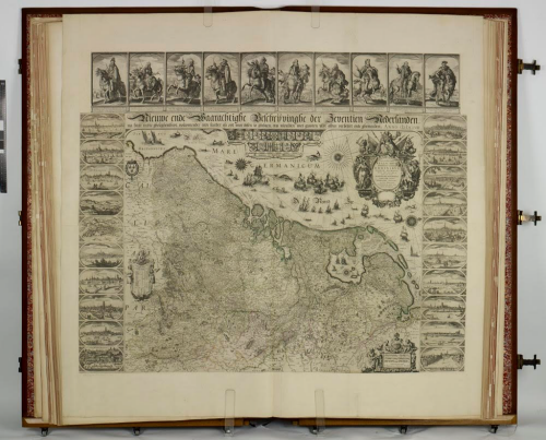
Blaeu’s work was meticulous, detailed and of a consistently high quality. His maps are all works of art in their own right and symbolic of the artistry of the Dutch cartographers and engravers of the time. The Klencke atlas is not merely an over-sized book and contains very little white space. Each map fills the large sheets in detail and the borders contain numerous illustrations of cityscapes and persons. Even the seas and oceans are adorned with sailing ships representing exploration and discovery.
A large, beautiful and historic atlas that represents a golden age of map-making. The atlas is large but it’s impressive cartography too.


