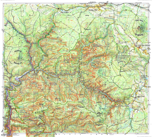
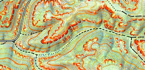
 Special purpose maps demand special purpose design in order that the unique characteristics are brought to the fore. Maps that support hiking and orienteering need a very detailed visual description of the landscapeand terrain that goes beyond a standard topographic map. For instance, while contours are prominent on most topographic maps they tend to dominate rocky outcrops and small cliff-lines. Of course, knowing precisely where these dangerous areas are is critical to avoid a serious mistake. This map, designed by Rolf Böhm brings a beautiful aesthetic to a map to support outdoor pursuits.
The map of Khaatal covers a popular hiking and climbing area south-east of Dresden in Saxony, Germany. Böhm, a passionate cartographer and hiker, depicts the unique natural character of the rock formations along the Elbe river with clarity. His process of making the map illustrates the care and attention to detail required for the final product. All in all the map is drawn 3 times – first of all there is the work in the terrain taking notes and making sketches, then the map is fine-drawn in hand at the desk on a white sheet of paper and finally it is finished using a computer.
The result is a map that attracts users with its artistic depiction of the unique landscape of Saxon Switzerland. The lively representation of the terrain consists not only of contour lines and hand-drawn hillshading (applied using watercolours) but is accompanied by an artistic depiction of the sandstone pinnacles which are classified by their height. Besides rock hachures indicate the direction and steepness of the rock formations…and all in a rich red that allows them to stand out and contrast with other map detail.
The choice of type style for the map lettering supports the impression of a traditional hand-drawn map. Nevertheless, the map provides high accuracy and rich up-to-date information for hikers and climbers.
You can see more of the map and the detailed process of its construction at Böhm’s web site here.

