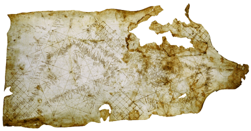
 The form of a map goes a long way to defining whether it is well designed but rarely is a well designed map devoid of function. The balance between the two is likely harmonious if we see beauty in the form and function. Sometimes the simplicity of the function defines the form itself and beauty is derived largely from how the map is designed to work. This is certainly true of the Carte Pisane, the world’s oldest known portolan chart. Derived from the Italian word Portolano, or port, this map is designed to allow mariners to navigate between coastal settlements.
Their construction is simple, being based on the use circles, lines and grids with numerous compass directions. Coastlines and names were added according to known compass directions so the map’s appearance is strictly according to the knowledge of compass and wind direction between two ports. It’s a simple and ingenious approach to making a map to support one function – getting from A to B by sea. The shape of a coastline was accentuated by labelling the ports at 90 degrees to the coastline.
There is little need for any interior geography and the commercial importance of various trading regions is clear given the relatively poor shape and detail of the British Isles.
History can teach us much about map design. The portolan chart and Carte Pisane are exquisite examples of early map-making.


