MapCarte 171/365: World of Rivers by National Geographic, 2007

MapCarte171_natgeorivers
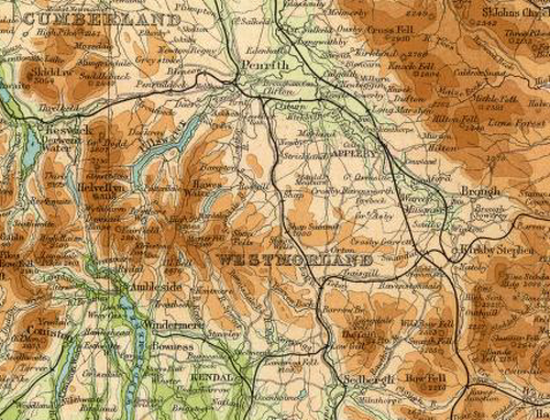
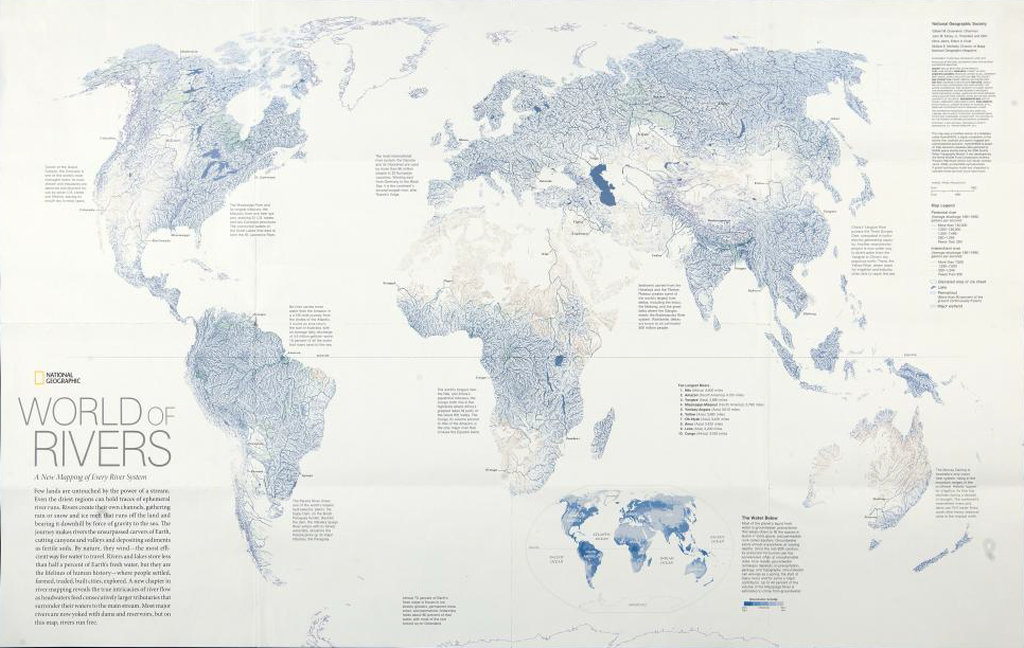
We’ve featured National Geographic maps and posters before in MapCarte because they are truly some of the most beautifully researched, designed and presented maps around. Their standard and commitment is of the very highest quality and non moreso than this 2007 poster of the world’s rivers and basins.

The map is built from a large georeferenced dataset that was used to create a detailed hydrological model of every river channel and the drainage basins it defines. It’s not really the intent of the map to illustrate every individual river channel uniquelly (for that, you’d explore the data interactively) but, rahter we get an overview. The colouring for river channels creates aa blue landscape with larger rivers classified by discharge and given prominence with wider, darker symbology. We get an impression of river network density and subtle green shading demarcates wetlands and red, arid areas.

MapCarte171_natgeorivers_detail

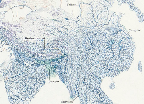
Major rivers are labelled and the map is fully annotated with information to enable the reader to explore further and interpret the detail accurately.

The map also illustrates how using one dataset can provide a world map with no other detail. There is no coastal outline present yet the map’s content defines the land and water boundary.

MapCarte 133/365: The Times Atlas of the World by The Times 1895-present

MapCarte133_timesExtract from the Times Atlas 2nd Edition, 1920

World reference atlases were once revered for their quality, consistency and magnificence as publications. No self-respecting household would lack a decent atlas. The ability to have a world atlas on your cellphone or tablet is certainly challenging the publishing model for such atlases but there is some way to go before the print atlas is consigned to history.

The Times Atlas of the World (latterly with the addition of Comprehensive Edition) was first published in 1895 and is currently in its 13th Edition.  Originally containing 117 pages and over 130,000 names it has grown to a 544 page publication with 125 map plates and over 220,000 indexed names and is marketed as The Greatest Book on Earth. It claims to be the benchmark of cartographic excellence and that’s some claim – though entirely fitting for such a well research work that exhibits well crafted, refined cartography. The 2nd Edition began a long association with Bartholomews as suppliers of the maps in the atlas and represents some of the richest and magnificent maps out of all the editions.

MapCarte133_times_detail

The 10th Edition, published in 1999, was the first to be produced entirely using computer cartography but until that time much of the map drawing was by hand. Unsurpassed global coverage of the world’s physical and political features in a single volume, the atlas is both prestigious and authoritative.  It has a classic style and traditional appearance and is meticulously presented.  Crucially, the intricate design has stood the test of time and the maps are beautifully laid out, easy to read and fascinating. Every aspect of cartographic design is executed to a high standard – composition and layout, colour and typography, balance, hierarchy, contrast and symbology.

In an age of querying the internet for answers, when questions of authority and accuracy remain, the Times Atlas is unparalleled and remains a reference publication of the highest quality.

You can view hi-resolution contents of two of the older Times atlases at the David Rumsey Map Collection including the focus here: the 1920 2nd Edition.

1895 1st Edition is an English version of the German ‘Andrees Allgemeiner Handatlas’ from the publisher Velhagen & Klasing.

1920 2nd Edition containing maps by Bartholomews

The current version is available via the Times atlas web site here.