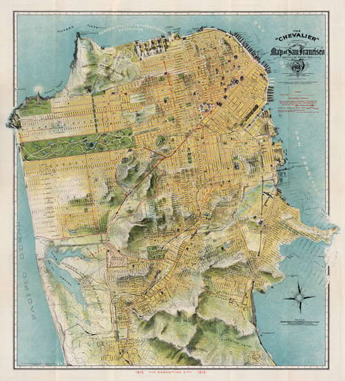
 Very rarely do we see maps titled in such a way that they go beyond the theme or subject matter of the work. More than that, how many maps do we ever see where the author adds their own name to the title. It’s a bold statement and one that’s difficult to pull off since recognising a piece of work by the author’s name is usually only conferred by peers after the work is published and widely admired. August Chevalier didn’t wait and his map of San Francisco bears his name. On this occasion any hint of self-agrandising might be allowed since the map is stunning.
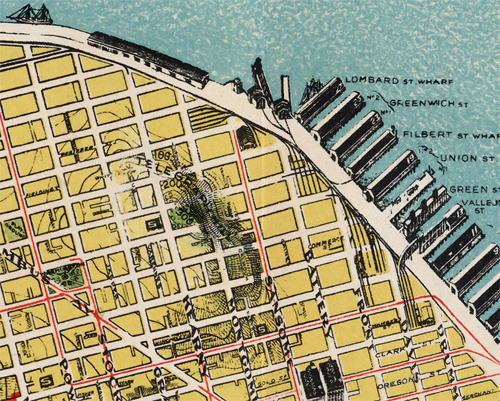
The “Chevalier” Commercial, Pictorial and Tourist Map of San Francisco (its full title) was designed and engraved by August Chevalier, lithographer and publisher. The original first edition was later published with improvements and additions in 1911. The map portrays San Francisco in a way that we rarely see today by emphasising the relief. For a relatively large scale (1:9,400), the map unusually employs contours to depict relief. More typically, it also shows all of the important buildings as life-like pictorial representations so in some respects combines techniques more often seen on different scales of map type. This works to great effect.
The map also uses hill-shading to accentuate the character of the topography and the clear and bold street names add local detail. The parklands are shown clearly as are the docks and other key places which become recognisable by their use. A neat trick sees Chevalier allow his map to extend beyond the graphic border. This gives an expression of the landscape continuing beyond the map and allows it to appear less constrained; a little more fluid. The shaded vignette effect used to depict the water is slightly patterned and also expertly applied to accentuate the landform.
This is a beautiful poster sized map that captures something of the city that modern maps overlook. San Francisco, like many cities, has considerable variation in land use and topography but our sometimes overly abstract representations and distillation of features to geometric shapes can lose some of the character. Chevalier proudly put his name to this map and he deserves the accolades.


Pingback: Data Viz News [55] - sqoops