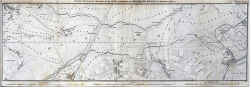
 If you’re going to make an accurate topographic map you need a place, a position of known origin from which to accurately measure. You need a baseline. The origins of Ordnance Survey in the UK can be traced to a survey carried out for King George III and The Royal Society between 1784 and 1790. It set about determining the positions of the Greenwich Observatory and L’Observatoire de Paris relative to one another and also the distance between the two. The survey was carried out by Major General William Roy under the authority of the Board of Ordnance. The first part of this assessment was the need to calculate a surveyed baseline which he set about doing across Hounslow Heath West London. Much of the land which Roy surveyed is now occupied by modern-day Heathrow airport
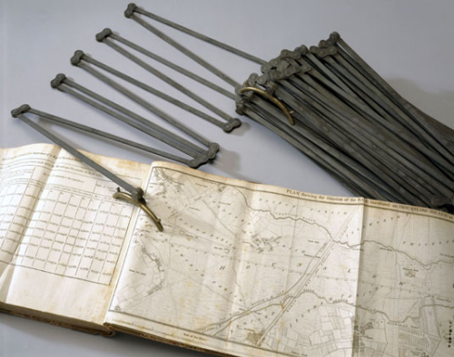
 Roy measured the baseline using metal rods, and later using glass rods to reduce the error due to the expansion of metal, and calculated the baseline at 27,404.01 feet. The line was re-measured in 1791 by the then newly established Ordnance Survey and found to be .23 feet longer…that’s less than 3 inches. In 1885 it was re-measured once again at 27,406.19 feet (5.19 miles, 8.35Km). In short, Roy had managed to measure a line using 1,370 placements of glass tubing, adjusted for temperature and mean sea level to an accuracy of 1 inch in 27,000ft, or 3 parts per million. This is an astonishing feet but one which subsequently allowed Great Britain to become arguably the most complete and accurately mapped place on Earth.
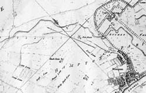
 Roy’s baseline was published in the Philosophical Transactions of the Royal Society and his work won him the prestigious Copey Medal. The extract above shows the baseline from west to east as it approaches Hampton Court Palace.
The connection of the Greenwich and Paris observatories by surveyed triangulation wasn’t completed until 1787 but Roy’s baseline also formed the basis for the topographic survey of much of southern England. These surveys were made using a Ramsden theodolite which Roy had commissioned himself (from Jesse Ramsden) and which were the start of the Principal Triangulation of Great Britain, carried out between 1784 and 1853.
The map is a remarkable achievement. It’s understated simplicity showing plots of major features as well as the baseline belies its scientific accuracy and importance.
