There’s nothing quite as absurd as a map-maker intent on capturing some phenomena to a ridiculous level of detail on a map. There’s something particularly impressive about such dedication and the search to create that perfect record that can be unsurpassed. Maps have always been seen as providing accuracy, precision and a documentary source so it’s no wonder that we can find all manner of individuals who take it upon themselves to dedicate huge numbers of hours to their cause.
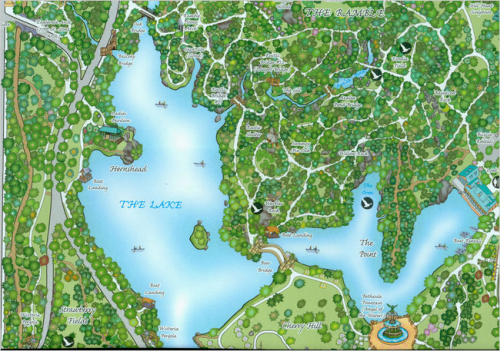
Edward Barnard and Ken Chaya are responsible for perhaps the most detailed map of trees ever produced. As a project that began innoccuously in 2008, it soon grew to become a tireless survey of every tree in Central Park, New York City. The resulting map is not just a record of the nearly 20,000 specimens but a beautifully detailed cartographic product.
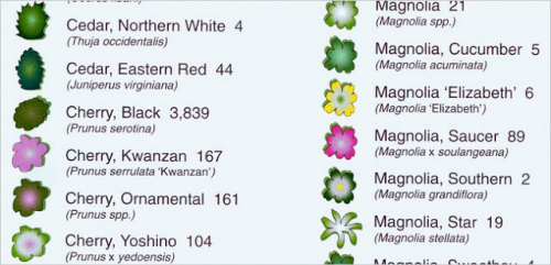
The map does not constrain itself to a standard paper size and is produced in the same aspect ratio as the park itself on a long thin vertical strip. It would have been easy to splice it up into sections and run them parallel on a standard landscape page but the impact of using a non-standard page size is worthwhile. The colours are vibrant and each tree species is given its own mimetic planimetric symbol. This adds colour, texture and shape to the map to give a sense of the distribution, size and type of trees.
Some elements of the park’s physical structure are presented in obliquely which provides anchor points and recongnisable places. These work well to create some sense of depth in the work.
Overall a beautiful map and testament to the dedication and perseverance of two men and their quest to make a map that had never been made.
More details at the author’s web site here.


