MapCarte 368/365: PAC-MAN Google Maps by Google, 2015

MapCarte368_pacman
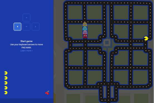
PAC-MAN Google Maps at Taj Mahal, India

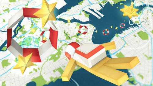
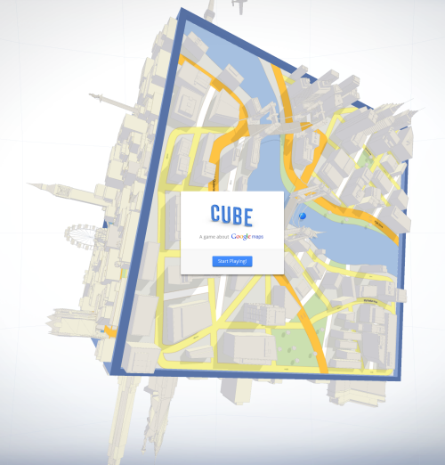
Take a classic map and combine it with arguably the world’s most loved video arcade game PAC-MAN. Genius! We’ve highlighted the importance and design credentials of Google Maps in MapCarte already (MapCarte 116) but the ability of Google to take their platform and come up with imaginative ways for us to engage with maps knows no end. Of course, they’re no strangers to using their map as a basis for a game as their Cube game demonstrated in 2012 (MapCarte 90)

You navigate the maze of streets as PAC-MAN, consuming pac dots and other bonus items while avoiding Blinky, Inky, Pinky and Clyde. The bonus items include the typical fruit icons from the original game but added are a Google Maps marker and Peg Man – nice touches. The game play is superb and very faithful to the original as you use cursor keys to move PAC-MAN around. They’ve even managed to get it working nicely on mobile devices using swipe gestures.

The re-styling of streets from Google Maps into the PAC-MAN maze is also faithful to the original with the dark background and neon blue maze structure being applied to street casings. It’s wuite simply a lovely re-imagination of the game and a fun way to repurpose the map to provide an entertainment medium.

Sadly, the game appears to be a temporary fixture for Google Maps but in marrying these two design greats they’ve proven that maps really can afford a template for all manner of purposes.

This video from C:NET illustrates the gameplay


Instructions to play Google Maps PAC-MAN are here.

MapCarte 280/365: GB Minecraft 2.0 by Ordnance Survey, 2014

MapCarte280_minecraft

Minecraft is a computer game that allows players to create and build places in which they can then play. The landscapes are built of 3D textured blocks and since its creation in 2009 many different worlds and environments have been built. Gameplay is supported by the procedurally generated 3D blocks. Britain’s national mapping agency Ordnance Survey has built an entire version of Great Britain as a downloadable world that players can then use in minecraft.

The map consists of 83 billion building blocks that represent the 220,000 sq km of mainland Britain and its surrounding islands, all built from Ordnance Survey data. Each building block represents a ground area of 25 sq metres and has been vertically exaggerated to reflect topography in a way that gives interest to low-lying landscapes.

MapCarte280_minecraft2

The original map was built by intern Joseph Braybrook who has now improved the detail in GB Minecraft 2 by adding trees in forested areas as well as more detailed hydrology and the rail network. Roads are also classified using Ordnance Survey’s familiar scheme. What better way to play in a computerised world than by using the real world, mapped by Ordnance Survey!

GB Minecraft 2 not only provides gameplayers with a beautiful world in which to play, it acts as an educational tool to explore geography.

You can read more about GB Minecraft and download it here and, inspired by Ordnance Survey, the British Geological Survey has build a geology world that you can also download here.

MapCarte 111/365: Mapdive by Instrument, 2013

MapCarte111_mapdive1

Click image to go to the web site and play MapDive.

Maps don’t have to simply provide us with reference information or a way to understand the world. They can simply just be art or provide a vehicle for entertainment. Here, Instrument showcase the Google Maps API and capabilities of the Chrome browser in creating an interactive game. It’s simple and effective.

Google’s map, itself, provides a bright and well crafted product suited to the screen. The player controls Google’s Peg Man (from the Streetview product) in skydiving gear as he hurtles towards earth (the map!) and attempts to navigate to a particular location (e.g. Statue of Liberty). You have to control the skydive through hoops and collect objects along the way but what makes the game so well produced is the way the map sits in the view, out of focus until you get closer to its surface. As you end your successful dive the fireworks begin.

Google Maps API: Map Dive Installation from Instrument

While you can play the game in the browser, the use of Google’s Liquid Galaxy shows how maps can provide a platform for an installation where players can navigate through motion-sensed gestures. There’s a highly complex set of technologies that work together to provide this capability and make the game play and experience so smooth and enjoyable. This mirrors the map itself – a lot of great work is required to make a product perform well.

We include Mapdive here because it’s a well designed piece of work that has a map as the central basis of the work. Instrument did not just rely on Google’s default map design though, they showcase a variety of styles by re-styling the base map to correspond to various climates. It’s also just fun and cartography can just be fun!

Plenty more details and images at the Instrument web site here.

MapCarte 90/365: Cube by Google, 2012

MapCarte90_googleClick the image to view the map and play the game.

Maps don’t need to inform. They can be fun. Maps can, of course, be fun and inform and in this example they can merely be fun! Cube, a Chrome experiment by Google is designed as a promotional tool for Google Maps. It’s a game, played in the browser, that has you attempting to control the orientation of a cube across which a ball is rolling. The point is to roll the ball to a destination on the three dimensional street map of each face. The game moves against the clock and as you succeed, the cube revolves and you’re challenged again.

What Google do well with this game is to make it simple. There’s considerable complexity in the design of the application but the interaction and game-play are intuitive. Because the game is based on the familiar childhood toys that require similar physical movement we automatically have a sense of the familiar and a desire to simply have a go. The map itself is in the typical style of Google Maps which since its launch in 2005 has matured well into a familiar and coherent style in its own right. The third dimension is rendered well with shadow, transparency and simplified buildings. An abstract view of the world and a fun few minutes.

The accompanying promotional video encourages us to ‘Explore your world with Google Maps’ and the use of a physical model of the digital cube is a great counterpoint and promotes the idea of simply playing with the map.