
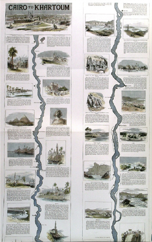
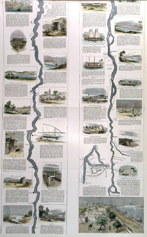
 Selection and omission is a key cartographic requirement. We make many decisions about the content of the map. One of the more dramatic consequences of this process is omission of all but a single geographic feature and this map of the River Nile from the late 1800s illustrates the principle perfectly. The whole river itself is over 4,000 miles in length and 2 miles in width at it’s widest. It passes through 11 different countries, though this map only illustrates the portion from Khartoum (where the Blue and White Nile meet) to the coast at Cairo.
General reference maps simply wouldn’t suit the purpose of highlighting the settlements and places along a river. The scale wouldn’t allow it and the amount of white space would make the balance of the map inappropriate. You’d be forced into adding all sorts of other topographic detail simply to fill space.
Instead, as a supplement to The Graphic, this map focuses on just the river. It becomes a linear cartogram with some segments straightened and a lack of almost all other topographic detail except for places that directly border the river itself. It’s akin to some of the classic early strip maps used to map roads and it translates well to a river. The river becomes the central anchor to the two page spread and around it are beautifully illustrated vignettes – panoramic scenes of the towns, villages and natural scenery along the river.
Maps can omit so much and still be perfectly suited to telling the story of the form itself. Here, the river and only the river. It makes perfect sense to omit all else.
