
 There’s arguably no more widely known figure in historical cartography than Mercator. His legacy has been the mathematical basis and projection developed and first used in his map of 1569. The map’s content at the time was rich and presented as complete a knowledge of the Earth as had been seen before. The projection, though, surpasses the content and is still the basis of many maps and, in particular, navigational charts to this day. The reason is simple – the Mercator projection allows one to plot straight lines of constant bearing (rhumb lines) which makes it a perfect map to support navigation.

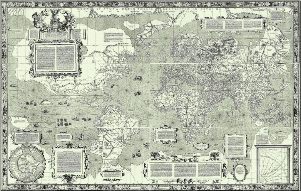
The map was produced across 18 separate sheets measuring a total of 202cm wide by 124cm tall. It was compiled from a range of sources including previous maps made by other cartographers, Mercator himself and portolan charts by Portuguese and Spanish sailors. These charts provided Mercator with the detail of coastlines that made this new projection so useful for supporting navigation. It was the first time the detail and projection had been used combined. The map is littered with cartouches and other marginalia including descriptions of the science of measurement that forms the basis of the map. In one such legend Mercator states that his first priority is “to spread on a plane the surface of the sphere in such a way that the positions of places shall correspond on all sides with each other, both in so far as true direction and distance are concerned and as correct longitudes and latitudes.”
A remarkable map of the time and one that continues to be used, and it has to be said mis-used, to the present.
