
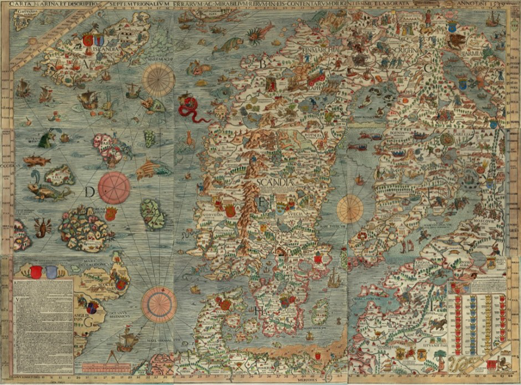
There’s something about hand drawn maps that draws cartophiles in. They more than often demonstrate the art of cartography simply because every mark has to be carefully thought through. This map is the first detailed map of Scandinavia and as a hanf drawn map it’s an absolute gem.
The symbology and colours, the typography and layout are second to none and demonstrate the very best of the art of cartography. Many of the defaults of modern software do not give this sort of final aesthetic yet with a little knowledge it’s not rocket science to replicate this sort of map.
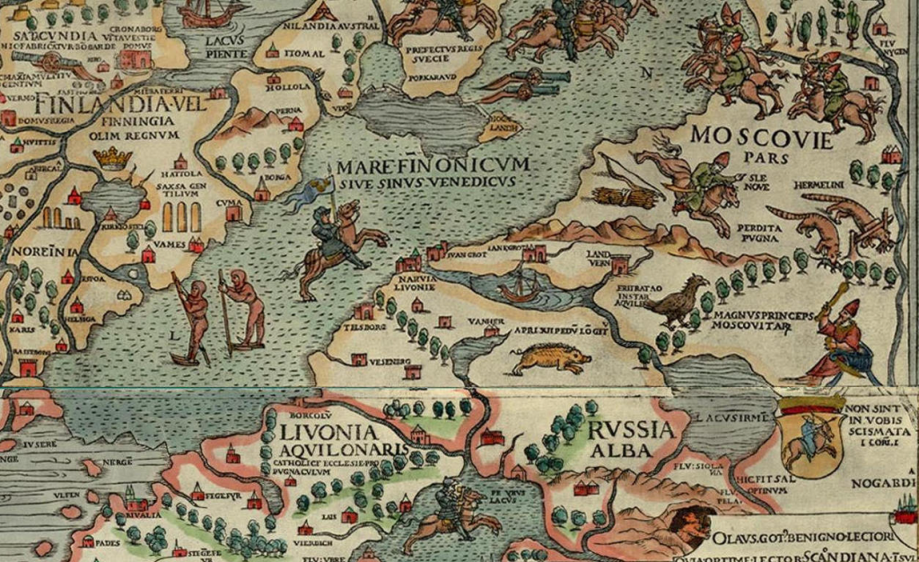
The detail and typography is exceptional and the graphical techniques for different land types is particularly impressive. Trees as mimetic symbols and patterns fills for the water bodies are especially well designed.
A lovely historical map that gives us strong pointers to how we might implement similar techniques on contemporary efforts.
