
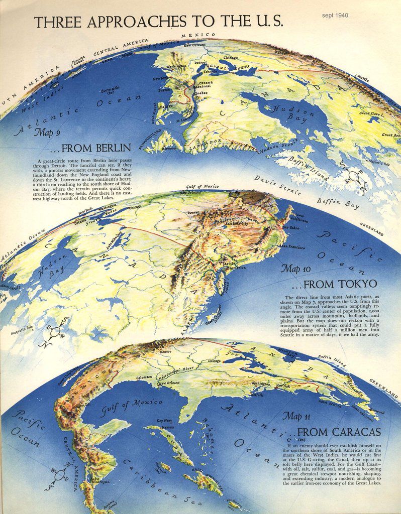
Richard Edes Harrison’s illustrations and, particularly, his fine illustrative maps have adorned countless magazine articles. This example for Fortune magazine shows three alternative approaches to the USA from Berlin, Tokyo and Caracas. The maps used a curved projection to show the US as it might sit on a globe but with exaggerations that made the foreground almost planimetric. The mid-ground was generally the focus of the piece and the distant curved over the horizon.
Colours are applied in a semi-realistic style to mimic landcover and the typography, as with all Harrison’s work is exquisitely applied by hand. There is, however, a somewhat sinister aspect to this map in the sense that the three approaches are viewed as if from the perspective of a potential enemy attack. The short passages of text postulate the route of a possible enemy and where their likely route might take them.
More of Harrison’s work for Fortune Magazine here.
