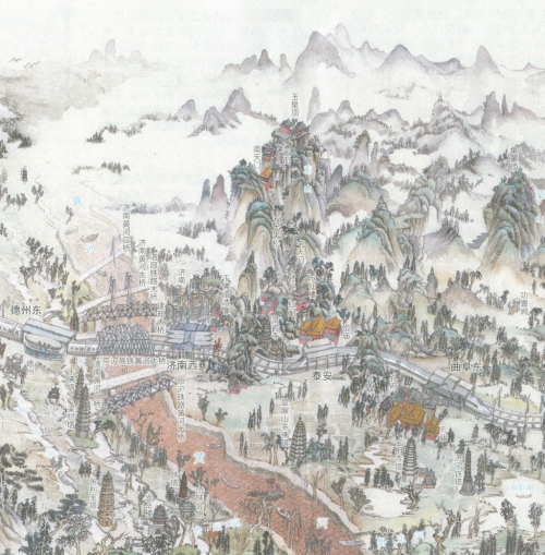
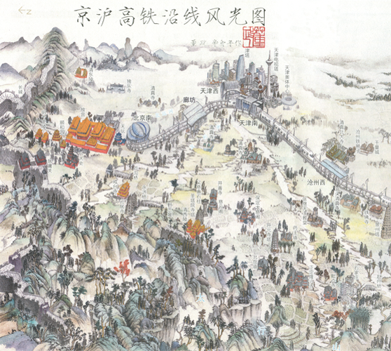
Strip-maps have often been used with great success to illustrate transport networks. They are well suited to linear paths. This example, drawn entirely by hand by Dong Sheng illustrates the roughly east-west orientation of the railway with Beijing on the left and Shanghai on the right. It’s a promotional device rather than a navigation device so what is omitted structurally we gain aesthetically. The birds eye position allows us survey a picturesque landscape that contains not only key features but also traditional Chinese symbology (such as the two flying cranes that represent longevity)
Sheng distorts the scale of many features, particularly the objects directly related to the railway itself to make them prominent. What he also does well is apply a subtle cultural dependence of aesthetics so the graphics and symbology are deeply rooted in the minds of the map’s intended audience. It plays on the familiar in terms of the content but also the imagery and the presentational representation.
 A fuller discussion of the map by Stephan Angsüsser can be found in Cartographic Perspectives no. 73 (2012) here.


