
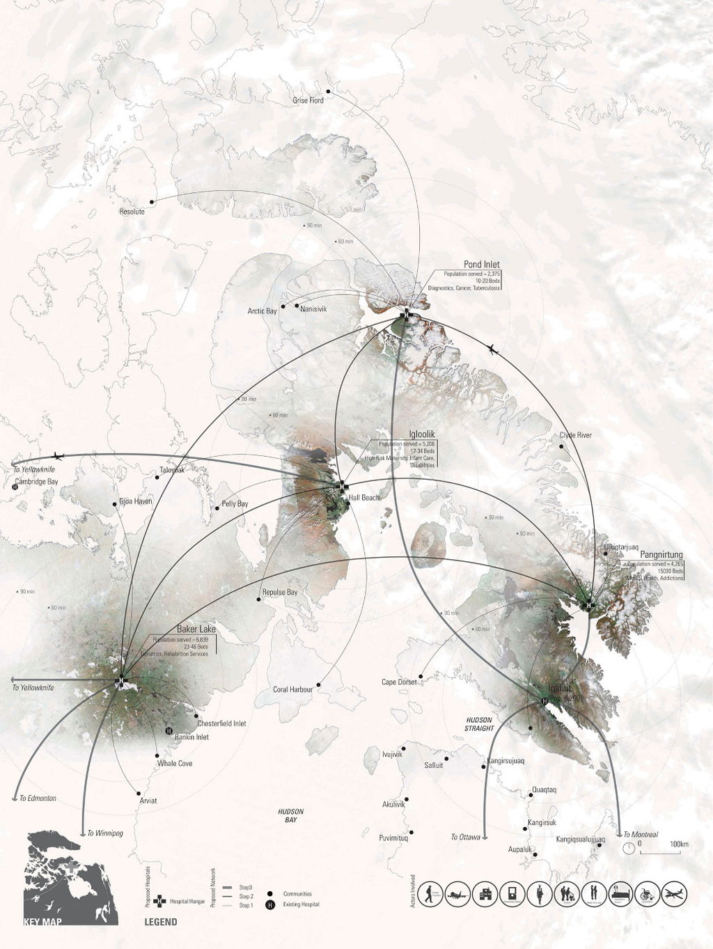
Maps don’t just tell stories or get you from A to B, they also provide a window into proposals, analysis and decision making scenarios. In that sense, maps support a very wide range of user needs. This example illustrates how maps can provide a way of seeing how a new proposal might be implemented. Nunavut has a disperse population, remotely located from major population centres yet which still require basic human needs such as health care. This map illustrates how a new system called Health Hangars might work.
Beyond the map’s use as a decision-making tool, it’s beautifully illustrated. The settlements that are the focus are shown in darker colours and more vivid representations which fade to the surrounding areas. This gives a way of leading the eye to the important places on the map.
The flight lines do not need to be curved yet they add a pleasing quality to the map, reminiscent of flow lines you’d see on a global flight map. The text is simple and purposeful and there are some excellent touches such as the width of the flight lines, the end points and the flourishes of greens in the settlements. The inset map and legend across the foot of the map are simple and effective.
All in all, a map that provides function with a form that mimics the natural environment of snow, ice and desolation to give the subject matter meaning.
More detail on the web site here.
