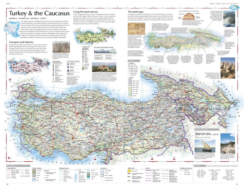
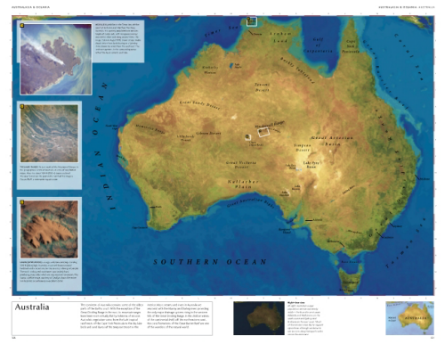
Dorling Kindersley first published their Millennium World Atlas in 1999, inspired by the success of their Eyewitness Travel Guide series. The latest version (published in 2008) contains 528 pages with rich, vibrant cartography, a wide range of cloud-free satellite images, high quality terrain models and fold-out pages.
Dorling Kindersley were one of the first to use satellite imagery linked to maps and as hybrid map/satellite image illustrations. Each page is beautifully presented with many using a unique approach of clipping map areas from their surroundings as opposed to allowing map detail to bleed off the edge of the page. This particular treatment allows the page to be filled with images, facts, illustrations and text which gives supporting information rarely found elsewhere in atlas mapping.
Each map features its own legend rather than relying on one in the preliminary pages. Given the amount of content and irregular shapes the balance, structure and harmony of each page is remarkable and the detail gives readers an opportunity to explore geography as a traveler rather than using the atlas merely as a reference tool.
DK have become expert at creating pictorial atlases that make each layout a rich source of visual and textual information. The maps are excellent but it’s the coherence they generate by bringing together a range of relevant content that makes their atlases so beautiful.


