
 Urban landscapes and rich stories of the places we inhabit are often not effectively captured using standard mapping techniques. Large-scale planimetric maps of the order of 1:2000 and above nearly always reduce a place to a surveyed chart. We see road edges and building outlines, all accurately plotted but which fail to convey any sense of the character of a place. That’s not their point and they are more suited to cadastral mapping and other requirements that demand clear, simple deliniation and from which smaller-scale products are subsequently generalised.
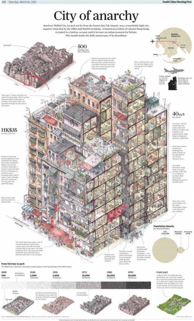
Imagine, then, the now demolished Kowloon Walled City, situated next to the old Hong Kong airport, Kai Tak. It measured 213m by 126m and consisted of densely packed high-rise buildings. Mapped planimetrically it would look something like the following:

Sure, you can see it’s dense buildings but it in no way gives you a sense of the place. The South China Morning Post have done though, with their superb isometric cut-away diagram showing the character of the place. The vertical was more important than the horizontal here as planes used to have to take a sharp 45 degree turn to land at Kai Tak to avoid a collision.
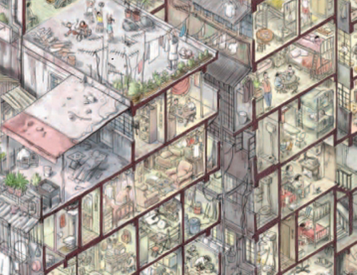
Now demolished and replaced by parkland, the city had over 500 buildings and some 50,000 residents by the 1980s with only 40 sq ft of space per person. This represents a population density some 280 times more than Hong Kong itself. The layout of the page is particularly well crafted with small maps, complete isometric maps and annotations providing the detail surrounding the incredible main illustration which is drawn in exquisite detail. The maxim of adding detail to improve clarity is well evidenced in this work and we get some sense of what the place must have been like.
A dystopian place that harboured extreme poverty and unsanitary conditions brought back to life by this unconventional yet excellent map.
