
 This MapCarte entry is more concerned with the illustrations and maps that Alfred Wainwright produced for his 59 walking guides and publications than specifically the Pictorial Guide to the Lakeland Fells series though they are perhaps the most widely known. The Pictorial Guide consisted of seven volumes compiled entirely of his own hand-written manuscripts, his hand-drawn maps and beautiful original illustrations drawn entirely in pen and ink. The Pictorial Guide has been in continuous publication since their first edition and remain as popular as ever. Their unique style and design that marries art, cartography and the written word brings a sense of romance to the long distance footpaths Wainwright wrote about and illustrated in such detail and with immense passion.
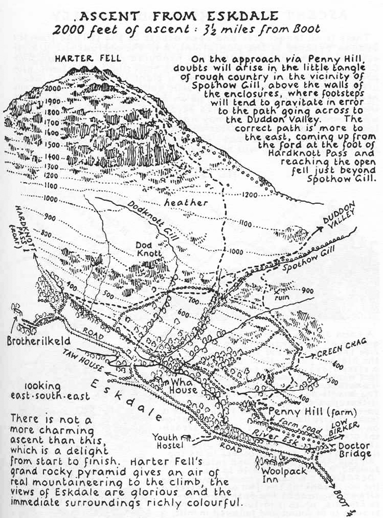
Wainwright’s maps are charming and bring to life not only the beauty of the landscapes he loved but also some of the desolation and isolation of the fells. The simple black ink drawings and maps lay bare the landscape yet contained a depth of detail and information that could only be re-told by someone who had walked every single mile and seen with his own eyes.
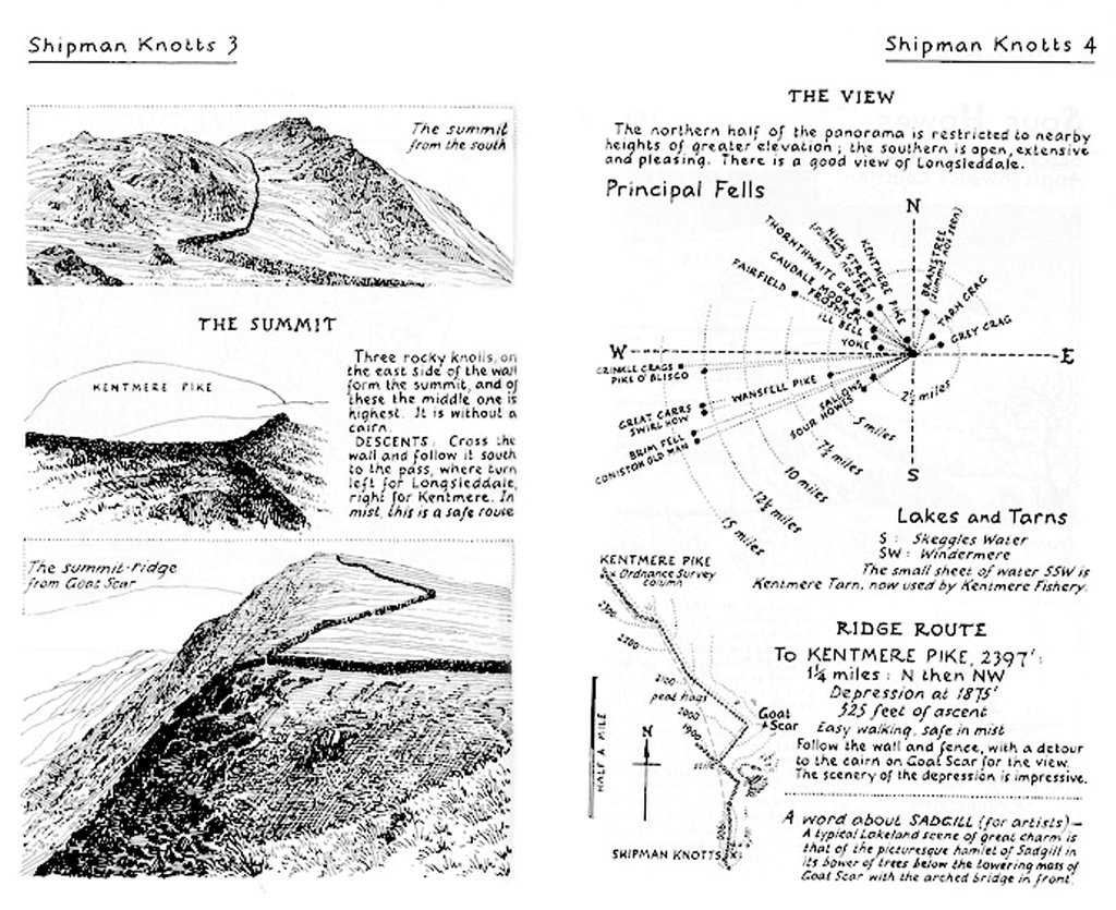
The ascent maps are planimetric in the foreground and morph to become perspective in the distance showing natural features and the climb ahead along the route. Contours not only provide useful information but add to the representation of the 3rd dimension. The hand-drawn approach lends itself to giving a sense that the maps are somehow more real and match their in situ use perfectly (as tools to support wayfinding). The maps are not just landscape sketches though. Planimetric detail is marked and pictorial symbols (e.g. trees) are also used to good effect. As a small format book the publications and the maps they contain are perfectly suited to their purpose. Many of the pages in the guides contain diagrams illustrating the directions of the fells on a compass rose. Drawings of key features as hikers would see them give a clear idea of location, scale and orientation. Small inset maps are littered throughout to bring clarity to specific parts of a route.
The Pictorial guides took 13 years to complete and are beautifully designed and constructed guidebooks that encompass the 214 peaks in the Lake District. The work is borne of a personal obsession but which clearly has the enjoyment of others as the driving motive. As such, the maps support navigation by all and are so much more than simply Wainwright’s own perspective. The cartography is exquisite but it is the bringing together of all the constituent parts of his guide book manuscripts that makes Alfred Wainwright’s work so enduring.

Pingback: Trail maps revisited | ofmapsandmapping