 Successful and elegant display of large multivariate data is rarely achieved because many attempt to fit their data into geographical space. Of course, geographical space is often a most inconvenient container for the data because of the constraints of size and shape; and with the smallest areas containing the most diverse and important data.
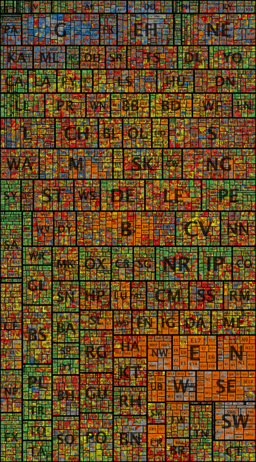
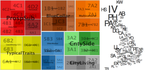
Cartograms have become a fairly typical way of taking the data outside traditional geography and ordering them in a different visual way to better display the relationships between areas. There are numerous examples but spatial treemaps not only allow you to show relationships across the data but detail within the data at different scales. Here, Wood et al. show 1,526,404 postcode units in Great Britain, sized by population and arranged so that geographical relationships and postcode geography hierarchy are maintained. The map is richly coloured according to a socio-economic classification comprising 7 super-groups split into 52 sub-groups that shows data concurrently.
The map is beautifully arranged allowing patterns in the vast amount of information to become clear at local, regional and national scales. In a single map, they have managed to effectively display detailed information about 60 million people recorded in 40 census variables in over 1 million places. The colour gives the appearance of a stain-glassed window inviting you to explore the information at different distances. Sans serif type is a good choice to tie in with the clean regular lines of the map itself and transparency allows large labels to be placed unobtrusively.
Higher resolution versions and more explanation are available on the giCentre web site here.


