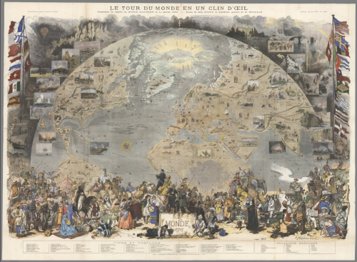
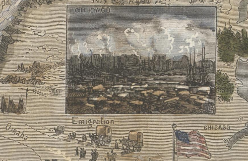
 Published by Le Monde Illustré, a 19th century French news magazine, this map demonstrates the artistry of the engraver Meaulle and designers M. Scott and D Vierge. Entitled ‘Around the World in a Wink’ the map was a supplement designed to pictorially illustrate the world using a view from space perspective. The map details flora, fauna, historic events, cultural artifacts and indigenous people. Insets are used to great effect to highlight particular places or moments of historic interest.
The map includes a wide array of national flags of major nations as well as figures in traditional costumes and the achievements of various explorers. The map tells a non-linear story and invites readers to explore the different parts of the world. It’s also an example of innovation and ingenuity in cartography since the map includes what appear to be photographs yet this was published in a time when photographic reproduction in print wasn’t technically possible. Instead, the solution was to create a wood-engraved version of the images in such detail that they take on the appearance of a photograph.
Cartographers often have to find workarounds to achieve a particular effect. This example illustrates how technical limitations do not necessarily limit the design.


