
Click on the image to view online web map
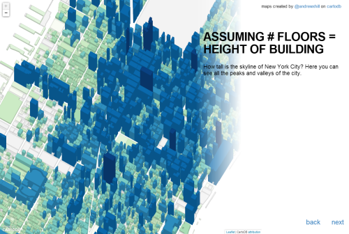
Andrew Hill expertly designs and stitches together a selection of maps that celebrate the release of New York City’s PLUTO dataset in 2013. This is more about celebrating the release of a major dataset than producing a ‘map’ yet the well crafted cartography is what makes the data shine. The PLUTO dataset contains tax lot level data from the NYC Department of Finance Tax Map. It contains land use and geographic data about the city’s five boroughs. Hill cycles through maps that each ask a single, simple question of the data. The map reveals the story of the city and uses multiscale design and user interaction where appropriate.
As you cycle through, the range of maps is well matched to each dataset and illustrated with simple, effective and eye-catching approaches. The collection illustrates how map choice has a major role to play in how we perceive the data. Of course, Hill could have presented most of the maps using standard choropleths but the result would not have been as compelling.
The maps were initially prepared to provide images for projection at a party so the original design needed to be impactful and visually stunning. The high contrast layout goes a long way to helping create a strong aesthetic. They also work as a linear gallery online, highlighting not only the data but high quality cartography, professionally applied in a clean UI.
