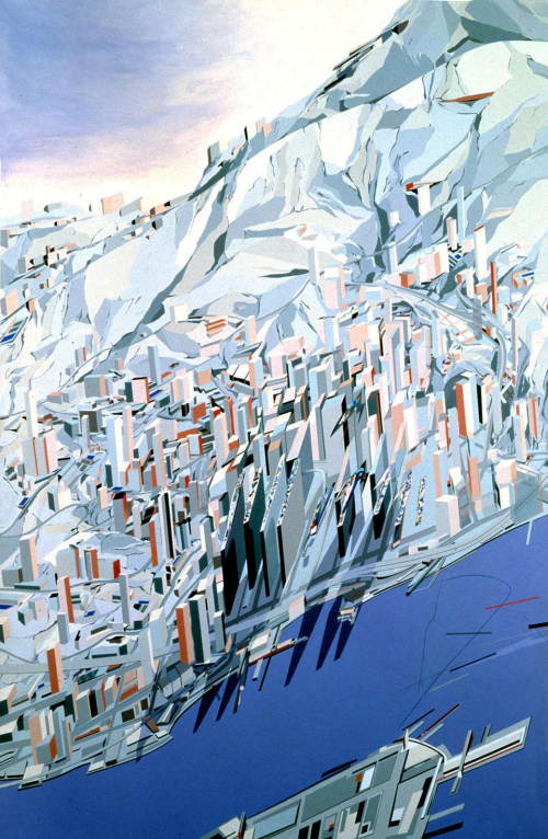
Doing something different is often a good way to bring attention to your design. Here, as a competition entry to design a proposal for an architectural landmark to stand apart from the congestion and intensity of Hong Kong, Zaha Hadid chose to veer away from the familiar approach of traditional elevations and axonometric projections.
The crucial element in her map was to place the water’s edge at approximately 30 degrees to the horizontal and present the buildings as almost vertical in the image. If you rotate the image so that the water and land are horizontal then, of course, the buildings make no sense. To emphasise the architecture and the man-made landscape (i.e. to focus on her design for the landmark buildings), she warped the terrain. This gives focus, but more so, a sense of drama and ‘difference’ because it’s not how we might expect to see Hong Kong harbour. The map reader’s interest is immediate and the challenge of seeing the landscape presented in this way creates interest.
The building design itself was described as ‘suprematist geology’ and required considerable excavation of bedrock. Because of this, the map here was intended to reflect the unique, modern appearance as both integral to the surrounding geology hence similar colours and shades are used for both the landscape and buildings. The club building was intended to represent the ‘high life’ so presenting the map in portrait, squeezing the image width and exaggerating height of the buildings also helped bring that sense of aspiration.


