
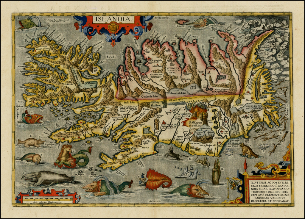
A highly decorative map. The first relatively accurate map of Iceland from indigenous sources published by Abraham Ortelius in various editions of his masterful Theatrum Orbis Terrarum. This map first appeared in the 1587 edition of Theatrum but the later versions (this is from the 1603 edition) had been refined, particularly in relation to the hand colouring. The content suggests Ortelius used many sources and the original map on which this is based is most likely drawn by the Icelander Gudbrandur Thorlaksson.
The mountains, fjords and glaciers are depicted in remarkable detail. Mount Hekla is seen erupting and it contains a wealth of detail about settlements and other points of interest…so in that sense this is an accurate, albeit stylised, topographic depiction. Perhaps the most interesting aspect of the map, however, is in the depiction of a fantastic array of legendary and mythical sea monsters from the 15th and 16th century. There are early depictions of sea horses and manta rays, walrus and even polar bears atop icebergs in the top right. Some fanciful creatures also exist and each is lettered, and has a short piece of associated descriptive text on the reverse of the map. A beautiful map that fills the empty voids with delightful curiosities.
