
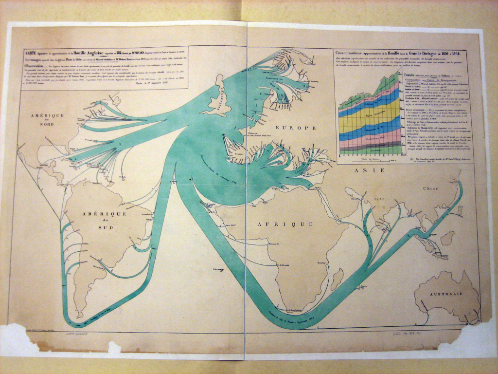
Charles Joseph Minard, French engineer and maker of maps (not a professional cartographer though) produced many memorable statistical maps. He can reasonably be described as one of the earliest thematic cartographers with a particular interest in plotting the quantity of a phenomena and its movement. Here, he created a distributive flow line map that shows the export of coal from Great Britain represented by line thickness. Each millimeter represents 20,000 tons of coal and as the lines branch off to different ports the ongoing line becomes thinner.
Lines are annotated with actual tonnage and there is a useful graph showing the eventual use of British coal that complements the overall page and tells a richer story than the mapped data alone. Minard’s use of colour is key to the success of the work. Light water, darker land and a contrasting colour for the figural flowlines. Simple and effective. Of course, the flowlines aren’t precise routes but that accuracy is unwarranted on a map such as this where the overall pattern of flow and trade is effectively communicated by a heavily generalised approach.

Pingback: MapCarte 69/365: The World According to Standard by Richard Harrison, 1940 | Commission on Map Design