
Click here to view an online zoomable version.
A large format poster provides the media for this map proving that size sometimes does matter in cartography. Sure, this could be presented on the web but the impact would not be as impressive. Sometimes a map deserves space and to be seen in its entirity at once (the irony here being we’re referencing an online version!).
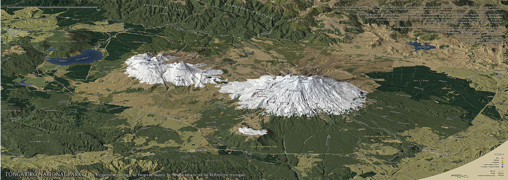
Geographx have become masters at creating 3D maps based on plan oblique and orthographic oblique projections that create a pleasing end product free from some of the distortions the more usual perspective view creates. The techniques create parallel projection lines and places the viewpoint at infinity. Crucially, they allow features in the landscape to remain figural and work particularly well in mountainous regions. Additionally, the photo-realistic textures and colours used give us a sense of place and the natural beauty of the landscape which is used to great effect here to highlight the snow covered slopes of Mounts Ruapehu, Tongariro and Ngauruhoe. The addition of more traditional topographic content (vector lines, point symbols and labels) allows it to go beyond merely the artistic and also serve well as a reference map.
