MapCarte 308/365: Madaba Mosaic Map by Anon, 6th Century

MapCarte308_madiba

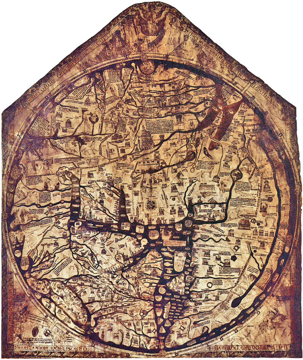
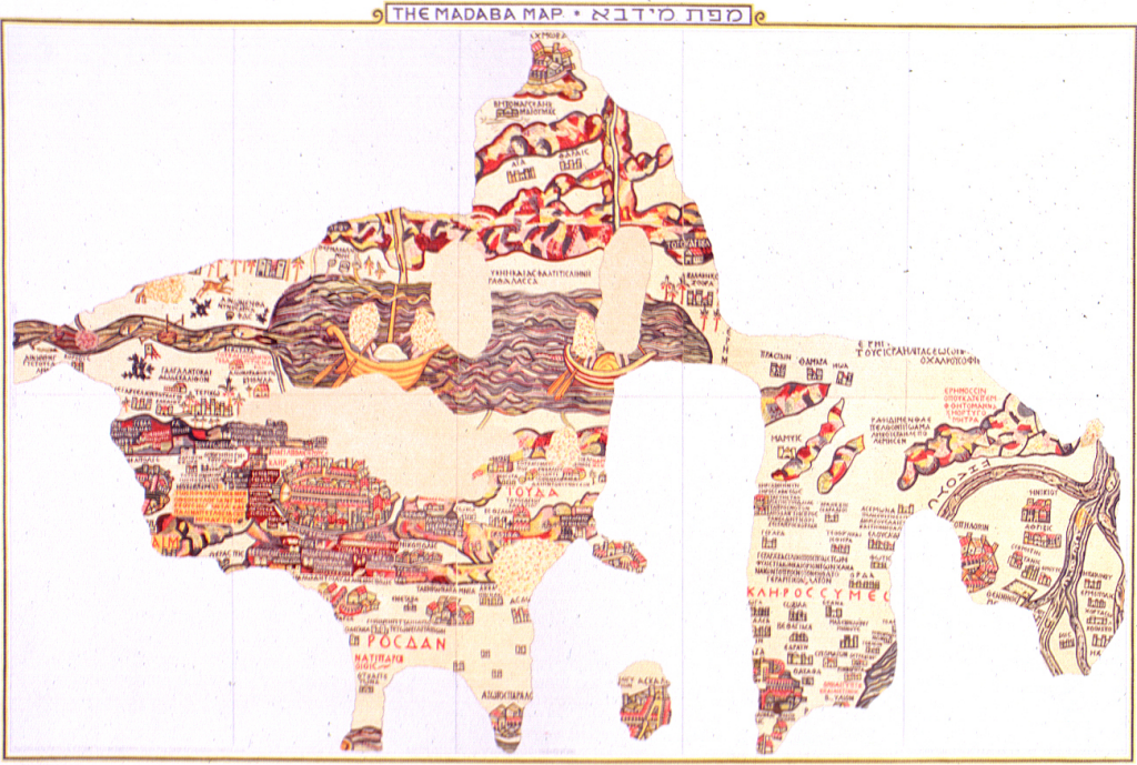
Art comes in many forms and many artists use maps as a vehicle for expression. The most impressive surviving example of Byzantine map-making is also the worlds oldest floor map. That is, a map on a floor made of mosaic tiles. It lies on the floor of St. George’s Church at Madaba in Jordan. Not all of the map survives as the image shows but the remaining segments clearly show the Holy Land with north upwards and Jerusalem in the centre. Topography and place names are present. Scale changes across the map which is an early example of exaggeration (as a process of generalization) to show areas of more importance as relatively larger. They required more space for the greater levels of detail.

MapCarte308_madiba_detail1

The map depicts scenes from the Bible as well as everyday life but the main intent of the map was to encourage religious pilgrimage. The detail and the intricacy of the map shows craftmanship of the highest order, both in designing such a work made entirely of mosaic tiles but also in its construction.

MapCarte308_madiba_detail2


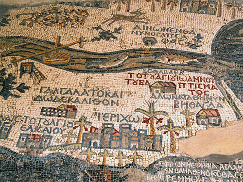
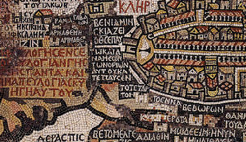
The map was created with the laying and setting of tesserae, small square shaped tiles of marble, limestone and coloured glass. The original map would have been sketched out then craftsmen would have laid the tiles. This is almost paint by numbers but the combination of the original designer and the craftsmen able to execute delivery of the map shows how maps are made through collaboration of people with very specific skills.

A beautiful and artistic mosaic tile floor…which happens to be a beautiful map too.

MapCarte 249/365: Hereford Mappa Mundi by Richard of Haldingham and Lafford, c.1285

MapCarte249_mappa

What can we possibly learn from historic maps? Well, the question is more like what isn’t there to learn from historic maps! Studying historical cartography not only gives us an unparalleled view into the world of that period but also gives us much prior art for contemporary cartographic design.

A mappa mundi is a form of T and O map dating from the medieval period. This most famous of all, the Hereford Mappa Mundi is the largest in known existence. It’s attributed to Richard of Haldingham and drawn on a single sheet of velum. The typography is in black ink, there are flourishes of red and gold and water is represented as blue or green. These all remain fairly standard cartographic conventions.

The map depicts biblical events, towns, animals, plants and scenes from mythology. Of course, it’s a product of medieval Christianity and as such, depicts the beliefs of the time. Jerusalem lies at the exact centre of the map which is precisely where modern map-makers also place the elements of most importance. There’s even a scene of cannibalism representing the location of the end of the world and which is inhabited by barbaric creatures.

MapCarte249_mappa_detailHistoric cartography gives us a sense of the past not only in terms of the content but also the way people illustrated their world. These are important historical documents not only for scholars of history but also for scholars of cartography.