MapCarte 230/365: Lübeck by Alfred Mahlau, 1934

MapCarte230_lubeck

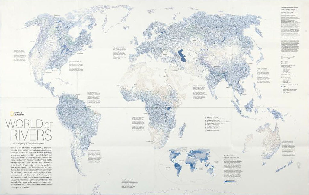
Maps can be used as powerful promotional pieces. When an artist or illustrator with a very unique aesthetic uses maps as part of their work we often see the map design take on strong elements of their artistic leaning. So it is the case with German painter and graphic artist Alfred Mahlau. Much of his work was in graphic design for advertising, textile patterns, sets and even stained glass windows.

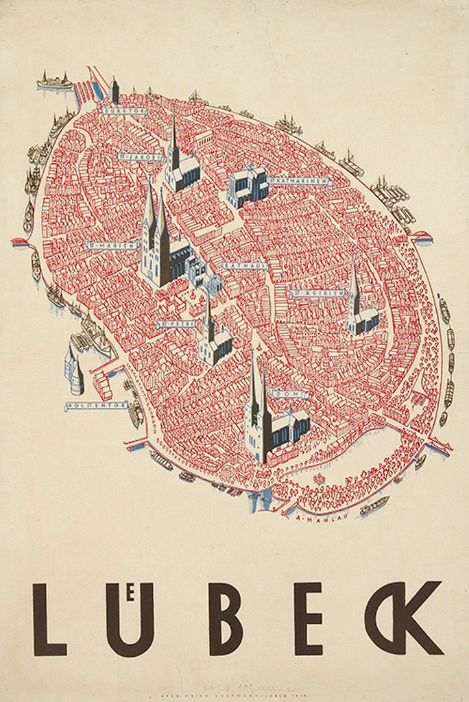
In general, Mahlau’s work was highly illustrative with minimal lines and strong blocks of colour. He was known for his lettering and his particularly clever way of dealing with umlauts as in this poster. Mahlau produced this poster, which has been reproduced in different colours and formats, as a promotional piece for the town of Lübeck in northern Germany which largely sits on an island in the River Trave and acts as one of Germany’s major ports. The island contains the old part of the city and as such has a number of historic buildings amongst a dense network of narrow streets that share the same red tile roofing and architecture.

Mahlau captured the essence of Lübeck in his perspective view. The many buildings are drawn in a similar style and the cathedrals and churches are seen rising above. It’s a simplified drawing but retains something of the character and charm of this small island settlement. The boats surrounding the island give away the fact it’s situated on water yet he cleverly uses subtle shadows to emphasise this aspect.

This view of Lübeck does way more than any aerial photograph or planimetric map could. It gives the town character and evokes a sense of place merely through the illustrative form.

MapCarte 171/365: World of Rivers by National Geographic, 2007

MapCarte171_natgeoriversWe’ve featured National Geographic maps and posters before in MapCarte because they are truly some of the most beautifully researched, designed and presented maps around. Their standard and commitment is of the very highest quality and non moreso than this 2007 poster of the world’s rivers and basins.

The map is built from a large georeferenced dataset that was used to create a detailed hydrological model of every river channel and the drainage basins it defines. It’s not really the intent of the map to illustrate every individual river channel uniquelly (for that, you’d explore the data interactively) but, rahter we get an overview. The colouring for river channels creates aa blue landscape with larger rivers classified by discharge and given prominence with wider, darker symbology. We get an impression of river network density and subtle green shading demarcates wetlands and red, arid areas.

MapCarte171_natgeorivers_detail

Major rivers are labelled and the map is fully annotated with information to enable the reader to explore further and interpret the detail accurately.

The map also illustrates how using one dataset can provide a world map with no other detail. There is no coastal outline present yet the map’s content defines the land and water boundary.

MapCarte 164/365: The Beautiful Game by Kenneth Field, 2010

MapCarte164_field

One from me…

There’s a world of difference between designing maps for inclusion in small format publications which are designed to be viewed at about 18 inches and a large format poster designed to catch the attention of someone as they pass by, perhaps fleetingly, in a gallery. This map was designed for the latter, the original being A0 size.

The poster displays the global distribution of national professional football teams. The use of a Dorling cartogram technique scales the symbols to the number of professional teams in that country. The cartogram neither maintains topology, shape of feature centroids yet we are still able to pick out that it’s a world map since most adjacent countries touch each other. The map could have been presented using a choropleth or some other standard mapping technique but when you want maximum visual impact you need to design something far more eye-catching.

The entire symbology  of the map is football related from the football sphere symbols that also contain team logos to the background of a football stadium. From a distance the football symbols seem to drop or dance about inside the stadium cauldron. National football association badges locate countries and symbols are grouped into FIFA confederations. The poster is designed to offer more than simple visuals though; it provides readers with a way to explore the structure of the game as well as the etymology of the term ‘football’ itself and how it varies globally with different vernaculars.

It deliberately uses saturated, vibrant colours that would not necessarily work for other presentations and in total it’s quite a visual assault on the eyes. Subtle it is not, but maps do not have to be subtle to be effective depending on the viewing environment. It won a few awards which is why it gets a mention in MapCarte. I even managed to add a little version of me sat in the stands just for fun.

Such one-off maps can have longeivity in a design sense too. I used a similar visual approach to a more recent map…the full history of the FIFA World Cup, published to coincide with the 2014 Brazil World Cup. This map used more conventional proportional symbols though still retained the football theme by adding a football design to the proportional symbols themselves along with a touch of shadow to provide some depth. An abstract basemap provides a simple backdrop:

MapCarte164_field2

You can view the web map here or download a copy of the full size print map here.