MapCarte 259/365: Yosemite Valley by John H, Renshawe, USGS, 1914

MapCarte259_yosemite

As more and more maps are created by digital means it’s easy to forget that many digital techniques still fail to achieve the artistry that a hand drawn map can bring to bear. Cartography has always been heavily populated by artists who have brought considerable graphical skill to the process of design and production but as we search for ever more automated techniques that more people can deploy we perhaps lose a little of that exceptional individual work. Hand drawn maps bring a style that can be as different and unique as a Monet to a Van Gogh or a Turner to a Banksy.

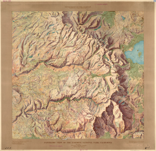
Here, John Renshawe shows us a rich palette of colour with deep browns and earth tones to depict Yosemite Valley. Lush greens and bright blues complement this excellent colour scheme that attempts to show the landscape as rich as one might find it in reality.
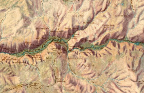
MapCarte259_yosemite_detailThe manually developed hill shade is particularly striking and though analytical hillshades have advanced tremendously, the ability of an artist to consider individual elements in the terrain rather than a computer’s approach of applying a technique systematically provides a unique and pleasing result.

The text sits comfortably in the map and the use of a border in a complementary colour completes the overall image. A beautiful, rich and warm map.

 

MapCarte 202/365: Escape Routes by Torgeir Husevaag, 2010-11

MapCarte202_escaperoutes


MapCarte202_meetingpoints

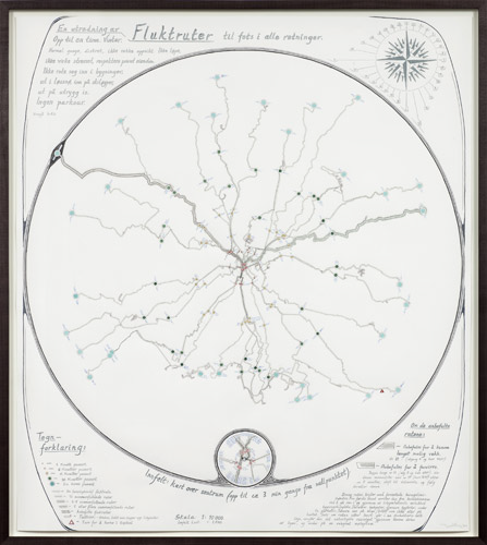
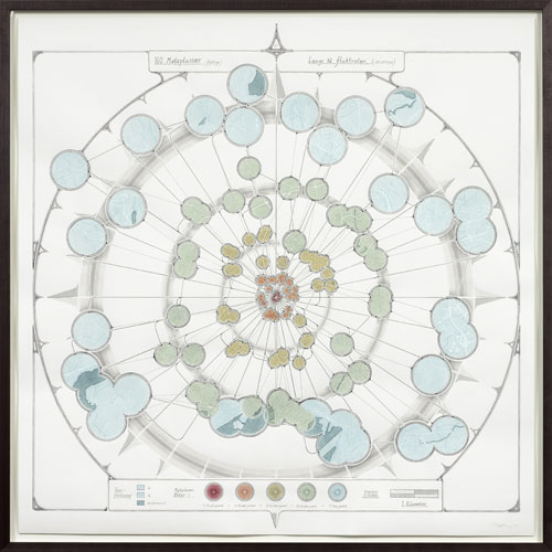
Designed as an exhibition piece in 2011, Escape routes and it’s counter piece Meeting Points offer an artistic interpretation of paths of movement through an unnamed city. The reason for escaping is not made clear so the maps are esoteric and unexplained in terms of a clear purpose yet cartographically they create an interesting aesthetic.

The first map, Escape Routes, plots the paths of 32 directions around a compass rose from the centre of the city showing the different characteristics of the escape route through symbology. The paths are defined as: Up to an hour. Wintertime. Moving discreet, not getting noticed, not running, staying cool. No trespassing. Keeping outdoors, avoiding ski tracks, deep snow, thin ice. No parkour. Avoid trouble. Again, these are somewhat obscure but point to the way in which the paths have been classified. Two are picked out for special attention – the first that shows the farthest you can reach in an hour; the second the path most likely to put off anyone pursuing. The detail in the symbology of lines created with dots and other small geometric marks shows clear differentiation in type.

The second map, Meeting Points, shows through increasingly sized circles the various places that one could meet at different times along the one hour journey. Each circle acts as a lens through which the otherwise obscured street network is displayed. This effect guides the eye to only those parts of a complex street network relevant to the theme. It focuses attention and declutters the otherwise noisy image.

An artistic interpretation of map form and function that creates an interesting aesthetic with practical cues which more purposeful cartography might borrow.

More images (but not much more detail) on the artists web site here.