It’s been a while… so why not meet up in Madrid?

Dear Map Design Community:

It’s been a while since this blog has been used. A lot has happened since the last post, in both map design and life. My apologies for the Commission’s absence. This falls on me.

For those of you who have stuck it out, thank you.

I plan to use this regularly again moving forward.

To reward your patience, I invite you to…

Submit a paper abstract to the upcoming conference –  Atlases in Time – taking place in Madrid, Spain, from April 20 – 23, 2022.  

The Atlases in Time Conference is being coordinated by three ICA Commissions, including Map Design, Toponyms, and Atlases, and Spain’s IGN to celebrate the organization’s 150th birthday.

Due to this conference being part of a birthday celebration, there are no conference fees. You only need to cover transportation, lodging, and meals. Field trips planned by the IGN will also be included – information on these is forthcoming.

For more information, please visit our conference website.

Or go directly to the Call for Abstracts page for more detailed information.

The deadline for submission is coming fast – February 15 – but the abstract needs to be 500 words or less, so don’t let the time crunch deter you! 🙂

If you have any questions, please don’t hesitate to contact me directly or reach us via our conference contact page here.

Let’s meet up in Madrid this April! I look forward to seeing many of you there.

Best,

Ian Muehlenhaus
Chair, ICA Commission on Map Design

——–

Official details extracted from the Call for Abstracts web page follow:

On the occasion of the 150th anniversary of the National Geographic Institute of Spain (IGN) being founded in 1870 – the IGN is the publishing institution of the National Atlas of Spain – the ICA Commission on Atlases, the ICA Commission on Map Design and the ICA/IGU Commission on Toponymy, together with the IGN and the Spanish Society for Cartography, Photogrammetry and Remote Sensing (SECFT) organise a conference on National and Regional Atlases from 20 to 23 April 2022 in Madrid.

During six sessions of four presentations each, questions concerning evolving dissemination concepts and techniques for atlases, recent development and examples of National Atlases as well as important map design and toponomastic issues in atlas production will be discussed.

Presentations will be held in a classic 20 min format of 15 minutes speaking with 5 minutes of discussion. A publication of the contributions as papers or abstracts will be carried out. Also accepted abstracts will be published using the ICA-Abstracts platform.

Your abstract shall not exceed 500 words and may be submitted as doc., .docx or .pdf-file.

Big in Japan!

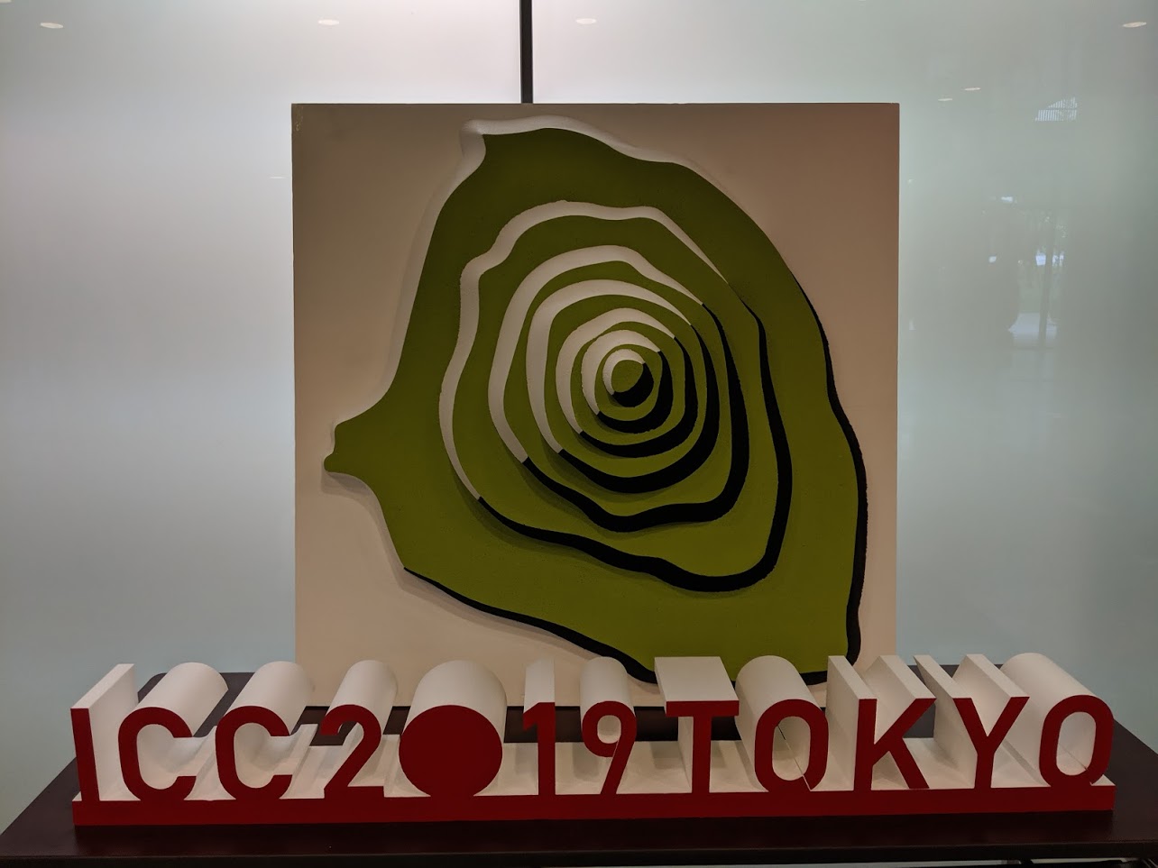
Commission Chair Kenneth Field and Vice-Chair Ian Muehlenhaus attended the 29th International Cartographic Conference and 18th General Assembly in Tokyo, Japan, 15–20 July 2019.


They hosted half a dozen paper sessions with nearly 30 excellent papers on the themes of map design. The papers can be viewed either in full, or as abstracts here, along with all of the other papers presented at the conference:

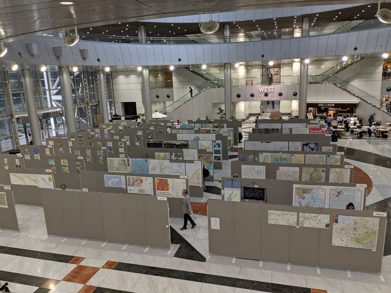
Field and Muehlenhaus also organised and chaired the judging of the International Cartographic Exhibition which saw nearly 400 maps and map products of all types on display.


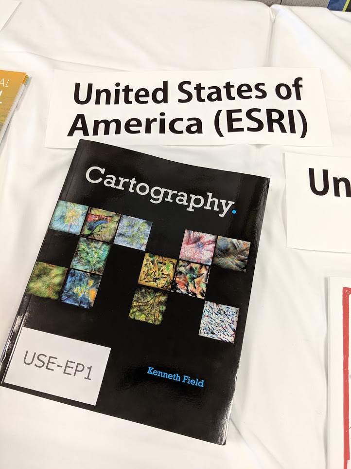
One of the products on display as part of the outcomes of the Commission on Map Design’s work in the period 2015-2019 was also recognised with an award. Cartography., authored by Kenneth Field won 1st place in the Educational Products category. We are particularly proud of this award given the Commission’s overarching terms of reference to help educate people in the craft of excellence in cartographic design. All 2019 awards can be seen on the main ICA website here.


After two terms as Chair of the Commission, Kenneth Field is stepping down and is replaced by Ian Muehlenhaus as the new Chair for the period 2019-2024. The Commission’s updated Terms of Reference for the period 2019-2024 were ratified at the General Assembly in Tokyo. Ken will continue to assist Ian as Vice-Chair. This change also means the Commission is now supported through the United States National Committee for the ICA after having been nominally under the United Kingdom Cartographic Committee under Ken’s stewardship.

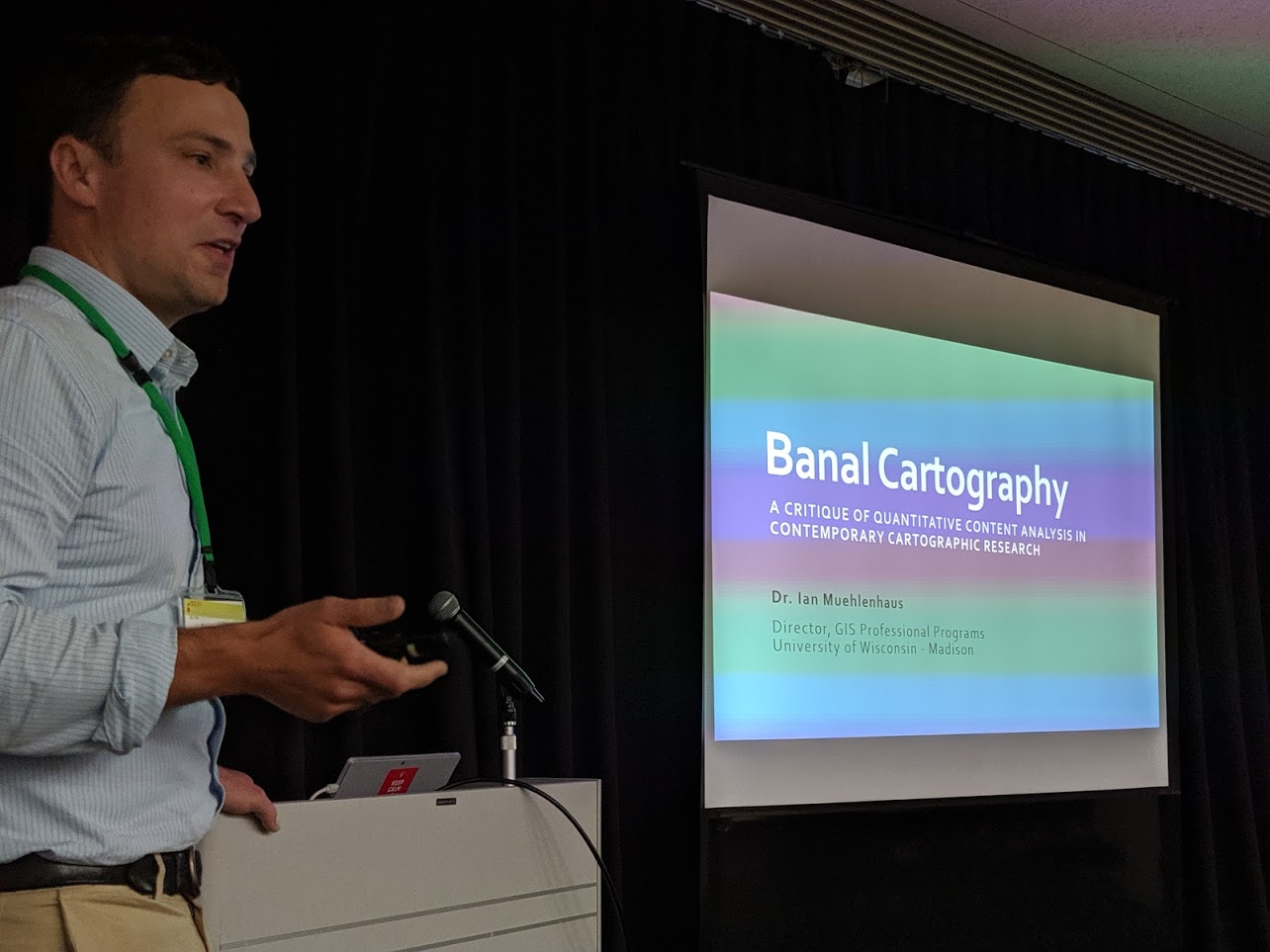
Here’s Ian presenting a wonderful discussion on banal cartography at the conference…so, one thing’s for certain, you’ll not find any banal map design stuff here for the next four years at least 🙂 Congratulations Ian, and good luck in your new role as Chair of the ICA Commission on Map Design.


Map Design Style Guides

Maps can be stylish. they can also lack style. Style, as in any art form can define fashions which can change over time. Some styles become timeless and some are fleeting. But how do we define this and, more importantly, how can we capture the essence of different styles to support the work of cartographers in general? We shouldn’t need to always begin with a blank canvas and search for coherent ideas.

Based on an original idea by Daniel Huffman, the ICA Commission on Map Design is picking up the baton to develop a crowd-sourced set of cartographic style guides. Each will bring together a set of ideas, examples and links to resources that will enable the reader to learn about and implement that style more easily in their own work. Why? Because the style guides will be based on expert knowledge and prior (c)art. What has gone before that works? How do different elements hang together? What colour palettes work? What fonts are best suited? How do I render my linework in a particular style?

This goes beyond simply colouring in a basemap but, instead, builds a portfolio of materials that can be used to create coherent, well-balanced and impactful maps. Imagine a set of materials that gave you a head start in creating a map in an Art Deco style…or a neon, firefly, steampunk, celtic, pop art aesthetic etc etc. How can we take design cues from art, furniture, architecture, film and build these out to apply to cartography? We’ve already seen examples of some of these styles, some we have yet to see. Bringing them together for the benefit of the wider community is the intent, and crowd-sourcing from the experts who have already thought this through will provide a remarkable set of materials.

During the latter part of 2016, Chair Kenneth Field will be presenting these ideas at a range of conferences. More details will emerge here over time as we define how the project will take shape.

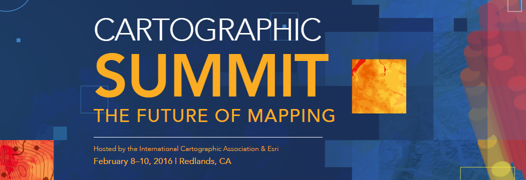
Cartographic Summit: The future of Mapping

cartosummit_banner

The International Cartographic Association and Esri are hoting an invite-only Cartographic Summit in Redlands, CA next week (8-10 Feb). Originally envisioned by ICA Immediate Past-President Georg Gartner and Esri President Jack Dangermond in Dresden during ICC 2014, the purpose is to support and enable discussion on how mapping is changing and what the challenges and opportunities are going forward. Current ICA President Menno-Jan Kraak will outline the shared vision on Day 1 followed by some terrific speakers and discussion.

ICA Map Design Commission Chair Kenneth Field and Vice-Chairs Ian Muehlenhaus and Damien Saunder will attend alongside a number of other Commissions to contribute to the discussions. They will also host a Map Design Commission networking event during the Summit.

Thought-leaders from a range of disciplines will come together to explore their perspectives and to contribute to this meeting. The event goes beyond cartographers talking to cartographers and involves people from academia, media, journalism, design, government and art. Shaping a future research agenda for cartography and establishing future needs from a wide range of people is crucial to building bridges across communities for which mapping (and cartography) are vital elements in enabling communication. Establishing changing needs and expectations is at the heart of a better understanding of how cartography should adapt over the coming years. From our perspective, design and design thinking is a crucial component of this going forward.

While the event itself is invite-only to provide a forum for discussion and sharing of ideas among the group of passionate people, the event acts as a springboard for wider dissemination and discussion. Blogs and a research paper will emerge from the event to support sharing of ideas and to promote further debate. To that end, the Monday and Tuesday are to be live streamed. Details for accessing the live stream:

Dates: February 8th and 9th
Live stream: details available via the agenda
Video link: video.esri.com/live
Password: carto.summ

After the event, videos of the main presentations will be available via the ICA web site.

The next four years

At the International Cartographic Conference recently held in Rio de Janeiro, Brazil, the International Cartographic Association General Assembly voted to re-approve the Map Design Commission for the term 2015-2019. As part of the process, we presented the tangible outputs from the first four years of our collective efforts. We have met, and exceeded our original terms of reference. The following activities (with lead organizer or contributor in parentheses) highlight the work of the Commission to date:

  • Set up a new web site (mapdesign.icaci.org) and Twitter account (@ICAMapDesign) (Field). At time of writing, 120 web site subscribers.
  • Themed session at the 2011 NACIS conference in Madison Wisconsin (Field, Oct 2011)
  • Co-organised (with ICA Commission on Cog. Viz.) two sessions at Association of American Geographers conference in New York (Field, Feb 2012)
  • Special Issue of The Cartographic Journal based on papers from AAG sessions in February (Griffin, Fabrikant & Kent eds, Nov 2012)
  • Field & Demaj two-part paper arising from Commission research published in The Cartographic Journal Vol 49.1 (subsequently won Henry Johns award for Best Paper in 2013)
  • Presentations at BCS Annual Symposium (Field, Kent Jul 2012)
  • Hosted paper session at GeoCart 2012 in Auckland, New Zealand (Field, Aug 2012)
  • Two-day pre-conference workshop ahead of GeoCart 2012 in Auckland, New Zealand focusing on thematic map design (Field, Aug 2012)
  • Hosted discussion meetings at Esri User Conferences (Field, July 2012, 2013, 2014)
  • One-day ‘Aesthetics of Mapping’ forum at NACIS conference in Portland, Oregon (Jenny, Oct 2012)
  • Series of three paper sessions on Map Design at Association of American Geographers conference in Los Angeles (Field & Turner, co-convened with Commission on NeoCartography, April 2013)
  • Special Issue of Cartographic Perspectives on Aesthetics in Mapping (edited by Jenny with lead article by Kent and further article by Kent, Field, Jenny & Hopfstock, No.73, 2012)
  • ICA Dresden pre-conference workshop (co-convened with ICA Commission on NeoCartography) (Field, Kent, Chilton, Turner Aug 2013)
  • Strong presence at ICC Dresden including paper sessions, business meetings. (Field, Kent, Jenny and Hopfstock all presented papers and chaired sessions, Aug 2013)
  • Organised, co-sponsored and managed the judging and awards for the FOSS4G Map Gallery, Nottingham (Field, Sep 2013)
  • Presentations at Society of Cartographers Summer School (Field, Kent, Chilton Sep 2013)
  • Lead article in GIM International tie-in with ICC Dresden (Field, Aug 2013)
  • MapCarte initiative: a daily blog highlighting and discussing great classic and contemporary cartography (Field, with some additional contributions by Kent, Demaj, Hopfstock, Jenny & others 2014)
  • Pinterest gallery of classic and contemporary cartography (com/icamapdesign/mapcarte) (Field, 2014)
  • Sponsored the world’s first ‘Mapathon’ at BCS Symposium (Field & Sharpe, Jun 2014)
  • Keynote address at GeoCart 2014, Auckland New Zealand (Field, Sep 2014)
  • Keynote at Society of Cartographers 50th Annual Summer School, Glasgow (Kent, Sep 2014)
  • Keynote address at IMIA (Americas) conference in Denver CO, USA (Field, Nov 2014)
  • Lead essay in NACIS Atlas of Design Volume 2 (Field, 2014)
  • Both Kenneth Field and Bernie Jenny have won multiple awards during the period for maps and work in map design including ICA Best Paper map Dresden 2013, BCS Special Commendation 2013, GeoCart 2014 People’s Choice, FOSS4G Best map and People’s Choice 2014
  • Co-hosted a series of paper sessions (with the Commission for Cog. Viz) at the AAG meeting in Chicago, April 2015 (Field, April 2015).
  • Co-organized a pre-conference workshop for ICC Rio 2015 as well as Commission members organizing paper sessions and giving papers (Field, Kent, Muehlenhaus, Aug 2015).

As we look forward to the second four years Bernie Jenny and Anja Hopfstock will be stepping down from their role as vice chairs of the Commission. Alex Kent will also step down as he is keen to pursue the development of a new ICA Commission on Topographic Mapping (approved at ICC 2015). We’re delighted to announce that Dr Ian Muehlenhaus (Geography Department, University of Wisconsin-Madison), who has been actively involved in a number of Commission activities, will become vice-chair for the period 2015-2019. Additionally, Damian Saunder (Esri Inc) will take on the role of vice-chair. Dr Kenneth Field will continue in the role of Chair of the Commission and records his thanks for the work Bernie, Anja and Alex put in to helping make the first four years such a successful one for the Commission.

The terms of reference for the period 2015-2019 will be:

  • To maintain, expand and improve the content on our web site and across our various social media platforms;
  • To add to the MapCarte initiative and develop the content into a book;
  • To prepare a major book that explores the interface of cartography, graphic and information design;
  • To take a leading role in the organization of awards at ICA conferences (at the request of the ICA Executive);
  • To organize sessions at ICA conferences in 2017 and 2019 focused on map design theory and practice;
  • To organize, sponsor or co-host Commission meetings either independent of or in conjunction with other cartographic events to promote map design discourse and practice;
  • To prepare one Special Issue of a leading journal of cartography to explore map design for new mapmakers; and
  • To collaborate with colleagues in other ICA Commissions as appropriate in complementary areas of interest.

Many of these initiatives are already underway. We’ve contributed in the region of 40 written entries to the new book ‘MAP’ by Phaidon Press. Ken and Damien are currently mid-way through writing a new text on cartography and MapCarte will continue as an occasional series.

If you have ideas, papers, blog entries, map critiques or, well, anything that relates to the role of design in cartography, that you wish to share through our web site then please get in touch with either myself, Ian or Damien. Similarly, if you are interested in the Commission sponsoring a workshop of small event focused on map design themes then get in touch!


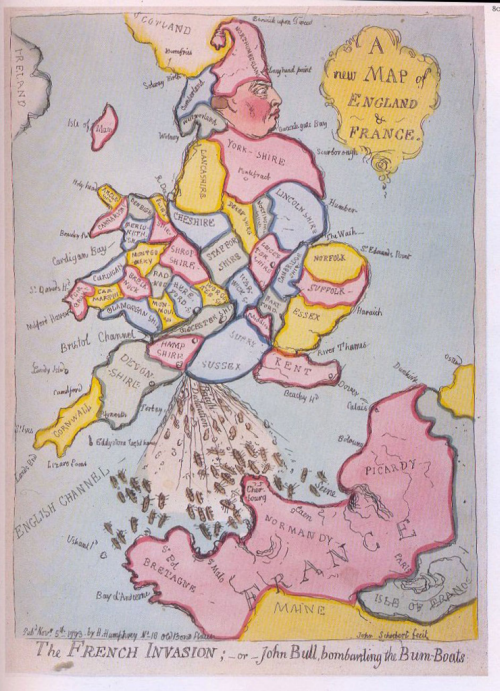
MapCarte 322/365: A new map of England and France by James Gillray, 1793

MapCarte322_gillrayMore satirical cartography in this MapCarte entry because maps are extremely powerful objects with which to convey a message designed to be politically charged or even propagandist. Here, James Gillray creates a caricature of England and its relationship with the rest of Europe, in particular showing disgust at nearest neighbours, France.

The map was created in 1793 amidst murmurings of impending French invasion as part of their wider revolutionary tendencies. How best to create a fervently patriotic show of distaste for invasion that is sure to increase sympathies to the ruling King and anti-French sentiment? Use a map! Gillray fits the shape of John Bull into the England and Wales. Bull, of course, is the stereotypical personification of England: a witty, jovial, stout matter-of-fact man. The French invasion of bum-boats is repelled by the defecating Bull from the ports of his ‘south coast’.

Even the French coastline is configured to look like a face with the stream of muck being thrown unceremoniously straight into the face itself. Gillray was a master of satirical caricatures and a commentator on political and social issues. This work captures the strength of feeling declared by King George III against the potential of a French invasion. Cartography as a vehicle for satire and commentary is indeed a powerful mechanism in the hands of a skilled craftsmen and although the sketch is merely that – a sketch rather than an accurate portrayal of topography – it needs no more than a general shape on which to hang the message.

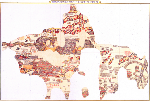
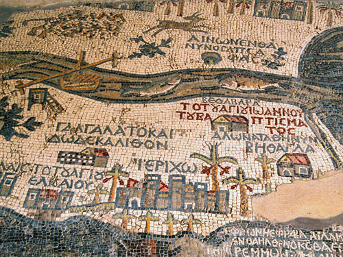
MapCarte 308/365: Madaba Mosaic Map by Anon, 6th Century

MapCarte308_madiba

Art comes in many forms and many artists use maps as a vehicle for expression. The most impressive surviving example of Byzantine map-making is also the worlds oldest floor map. That is, a map on a floor made of mosaic tiles. It lies on the floor of St. George’s Church at Madaba in Jordan. Not all of the map survives as the image shows but the remaining segments clearly show the Holy Land with north upwards and Jerusalem in the centre. Topography and place names are present. Scale changes across the map which is an early example of exaggeration (as a process of generalization) to show areas of more importance as relatively larger. They required more space for the greater levels of detail.

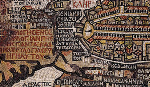
MapCarte308_madiba_detail1

The map depicts scenes from the Bible as well as everyday life but the main intent of the map was to encourage religious pilgrimage. The detail and the intricacy of the map shows craftmanship of the highest order, both in designing such a work made entirely of mosaic tiles but also in its construction.

MapCarte308_madiba_detail2


The map was created with the laying and setting of tesserae, small square shaped tiles of marble, limestone and coloured glass. The original map would have been sketched out then craftsmen would have laid the tiles. This is almost paint by numbers but the combination of the original designer and the craftsmen able to execute delivery of the map shows how maps are made through collaboration of people with very specific skills.

A beautiful and artistic mosaic tile floor…which happens to be a beautiful map too.

ICC 2013 preconference workshop “Mapping in a digital world”

Organized by the ICA Commissions on Map Design and Neocartography, this one-day workshop pre-conference to the ICA International Cartographic Conference 2013 will explore practical themes relating to the design and creation of effective online maps and information products. The updated schedule is now available below and we very much look forward to your participation in Dresden this coming Saturday (24th August 2013).

Morning presentations by a range of acknowledged experts in the field will seek to provide an overview of the state-of-the-art as well as touch on some of the challenges we face. Afternoon presentations will look at more specific user-oriented projects. We will share ideas and seek to develop common threads to take work in this area forward as part of a series of lightning talks and a panel discussion. Please come prepared to participate…

The workshop is being held in Room 101, 1st floor of the Lecture Hall of the TU Dresden, Bergstraße 64, 01069 Dresden, Germany

We aim to start at 9:30 and we are providing full morning and afternoon refreshments as well as lunch. There is no cost to attend the workshop.

There’s still time to join us and participants can Register Here

Schedule

09:30 – 09:40      Welcome and introduction (Kenneth Field, Esri Inc and Steve Chilton, University of Middlesex)

09:40 – 10:00      Thoughts on the future of mapping in a digital world (Georg Gartner, President of ICA)

10:00 – 10:30      New paradigms in digital, interactive realtime cartography (Andrew Turner, Esri Inc)

10:30 – 11:00      The aesthetics of mapping (Alex Kent, Canterbury Christ Church University)

11:00 – 11:30      Break (refreshments provided)

11:30 – 12:00      The state of the mapping API (Gary Gale, Nokia)

12:00 – 12:30      Re-Designing the Next Generation of Multi-scale World Topographic Maps: A Changing Landscape (Damien Demaj, Esri Inc)

12:30 – 13:30       Lunch (lunch provided)

13:30 – 13:50       Multiple ways to depict the World (Julia Mia Stirnemann, Universität Bern)

13:50 – 14:10      Color for Online Mapping: Still difficult to choose (Beate Weninger, HafenCity University Hamburg)

14:10 – 14:30      Map activities in Wikipedia and the cooperation with OpenStreetMap (Tim Alder, Wikipedia/OpenStreetMap activist)

14:30 – 14:50      It’s Not Just Interactivity: Web Map Layout, Design, and Aesthetics (Ian Muehlenhaus, University of Wisconsin, La Crosse)

14:50 – 15:20      Break (refreshments provided)

15:20 – 16:00       Lightning talks by participants to be determined unconference style

16:00 – 16:45       Panel discussion led by the organisers

Panel: Andrew Turner, Gary Gale, Damien Demaj, Alex Kent, [led by Kenneth Field & Steve Chilton]

The panel will be invited to discuss a range of themes that have emerged throughout the day and also topics that the participants wish to explore.  In particular, we’re keen to explore how a research agenda for design in online mapping might be shaped for the next few years.  What are the major challenges and opportunities?  How might these be approached and, possibly, solved? What can the ICA Commissions do to push forward research and/or action?

16:45 – 17:00 Closing remarks

Organizers: Kenneth Field, Alexander Kent, Bernie Jenny, AnjaHopfstock (ICA Commission on Map Design); Steve Chilton, Manuela Schmidt, Andrew Turner (ICA Commission on Neocartography)

There’s still time to join us and participants can Register Here

Call for Papers: Special Cartographic Perspectives Issue on Aesthetics in Mapping

Special editors: Aileen Buckley, ESRI, and Bernie Jenny, Oregon State University

At last year’s annual fall NACIS meeting (October 18-19), a special series of events took place around the subject of the aesthetics of mapping. The goal was to bring together members of the NACIS community and invited participants from outside the cartographic community to encourage cross-disciplinary communication around the central subject of the aesthetics of mapping. The events included a forum that convened during the first two sessions on the first day of the conference. It was clear that the subject of aesthetics and mapping is of great interest to many in the cartographic community as well as outside of the cartographic mainstream. As a result, we are compiling a special issue of Cartographic Perspectives (CP), the online NACIS journal, around this theme.

All papers will be carefully reviewed by at least three reviewers. Papers can be submitted in the formats below following the CP author instructions (http://nacis.org/documents_upload/AuthorsInstructions.pdf). Accepted papers will be published in the special CP issue.

  • Research article (2500 words or more)
  • Review paper on historical or current developments or ideas (2500 words or more)
  • Short papers on a select aspect of the topic (1000‐2000 words)
  • Short opinion piece describing a select viewpoint (1000‐2000 words)
  • Comments on a topic raised during the aesthetics sessions at the fall 2012 NACIS meeting (1000‐2000 words)
  • Design study using commented map examples (1000‐2000 words)
  • Hidden treasure ‐ very short article identifying and explaining the significance of outstanding articles, figures, ideas and maps published in the past that are perhaps not well known by most cartographers (500 words)

Important dates

  • March 1 ‐ Paper submission
  • March 22 – Notice of acceptance
  • April 19 Final camera‐ready submission
  • The special issue will be released in May.

Please send submissions to Aileen Buckley (abuckley@esri.com) or Bernie Jenny (jennyb@geo.oregonstate.edu).

NACIS 2012 – The Aesthetics of Mapping Forum (Part 2)

At this year’s annual fall NACIS meeting, a special series of events were planned around the subject of the aesthetics of mapping. The goal was to bring together members of the NACIS community and invited participants from outside the cartographic community to encourage cross-disciplinary communication around the central subject of the aesthetics of mapping. The events included a forum that convened during the first two sessions on the first day of the conference (Thursday, October 18).

In the first session, forum leaders introduced the subject and laid out the agenda. Dr. George McCleary, from the Department of Geography at the University of Kansas, then presented a keynote address titled “Beyond Map Layout and Design…Aesthetics?”, in which he traced the development of studies in aesthetics in art, cartography, and related fields.  His research has lead George to consider aesthetics as “unity in design”, with the result that the map “looks right” and the map “works”.  Presentations were then delivered from presenters with three different perspectives from outside the field of cartography.  Johannes Moenius, a professor in the School of Business at the University of Redlands in California, presented his work in Spatial Economic Analysis with special emphasis on his application of GIS and visualization to the effects of technical standards on trade flows and the dynamics of comparative advantage. Elijah Meeks, the digital humanities specialist at Stanford University, discussed projects that he has worked on that give Stanford faculty access to project design, visualization, and software development oriented toward the creation of digital scholarly media. He demonstrated a number of projects including the Republic of Letters and Orbis, a geospatial network model of the ancient Roman world. Lillian Larsen from the Department of Religious Studies at the University of Redlands, and Steve Benzek of the US Army Geospatial Center, then presented jointly on a project to map the travels of Paul the apostle. Stuart Allan, of Allan Cartography and Benchmark Atlases, and Nathaniel Kelso of Stamen Design, were then requested to offer commentary on the presentations. Subsequently, the floor was opened for discussion which was quite lively given the large number of attendees and the interesting topics that had been presented.


After a short break, the forum continued with presentations from two long-time NACIS attendees, Daniel Strebe and Mark Denil.  Mark kicked off the second session with a presentation titled “Style and Taste” in which he defined style as a collection of appropriate choices of graphic elements which can therefore can be “parameterized”, whereas taste requires selection and arrangement of the style choices.  Dan followed with a presentation titled “The Impotence of Maps, or Deconstructing the Deconstruction of their Construction” in which he offered a number of somewhat controversial views, including the decreasing importance of maps and the suggestion that not all maps should be made for all people. These presentations set the stage for an extended discussion with the audience and the forum participants. Stuart Allan and Nathaniel joined all the morning’s presenters at the front of the room so that audience members could ask questions of the forum participants and offer their comments.

Topics that came out of that discussion included the following.

  • What does “aesthetics” mean? Does it matter if we do not specifically define the term? This conversation was spurred by many comments from audience members and forum participants, but especially George’s keynote presentation on the historical development of thinking about aesthetics in various disciplines, as well as Leland Wilkinson’s definition of aesthetics as “perception.
  • Is aesthetics akin to informational fidelity, a conversation that was sparked by Lillian’s opinion that the “beautiful map” was the one that most accurately depicted the nature of the data and was therefore graphically elucidating. For these types of maps, what you are showing is in sync with the data.
  • How role does graphical fidelity play? This conversation was triggered by Gordon Kennedy’s comment about making maps that look historical by using techniques that were used at the time. He suggested that how you are showing something has to be in sync with what you are showing.
  • There was quite a bit of discussion relating to the “scratchy map” (the map of the journeys of Paul the apostle by Steve and Lillian).  A central topic was using mapping techniques that automatically allow the reader to perceive the true nature of the data, which are especially useful for “uncertain” or “incomplete” data. There was also a discussion of the concept of an “aesthetics sliders”, which some people found disturbing.
  • The topic of clarity as a requirement for aesthetic design was also raised. Dave Imus remarked that in his experience, clarity often leads to people finding a map aesthetically pleasing. Sven Furhmann questioned whether “clarity is for map readers who don’t have time” and “aesthetics are for people who do have time”.
  • Also discussed was the subject of aesthetics in situations where you give the control to the map reader. This conversation was spurred by Elijah’s presentation on mapping complex data in a compelling and understandable manner using an interface that allows readers to control the display. This raised the issue of the effects of multiple perspectives and modular approaches on the aesthetics of the maps.
  • People also discussed the need to get peoples’ attention (or “the business case for aesthetics”), which was theme that was introduced in Johannes’ presentation on aesthetics for maps of economic variables.
  • The subject of map critique was also raised when Martin Gamache asked about teaching critique methods in schools. Cindy Brewer responded that the goal of teaching critique is to shape students’ understanding of what a good map is rather than ask their opinion about good map design.
  • Daniel Strebe’s presentation on “the Impotence of Maps” sparked a lively discussion about the utility of maps. He also questioned the authority of maps and whether we should/can slough off some audiences for some maps.

These topics were revisited to some extent the following day when interested participants met at Stanford’s Restaurant to discuss the presentation for the closing session of the NACIS conference in which Aileen would recap the events and share a summary with attendees at the annual NACIS banquet.  It was clear that the subject of aesthetics and mapping is of continuing interest to many in the NACIS community as well as outside of the cartographic mainstream. As a result, there are plans to compile a special issue of Cartographic Perspectives, the online NACIS journal, around this theme.  There was also a suggestion that this theme be addressed again at next year’s NACIS conference, albeit in perhaps a different format. There was general consensus that one of the most productive and useful outcomes of the events that centered on the theme of the aesthetics of mapping was the opportunity to bring together members of the NACIS community and participants from outside the cartographic community to discuss a theme of shared interest.

Report by Aileen Buckley, Professional Cartographer, Esri Inc.