
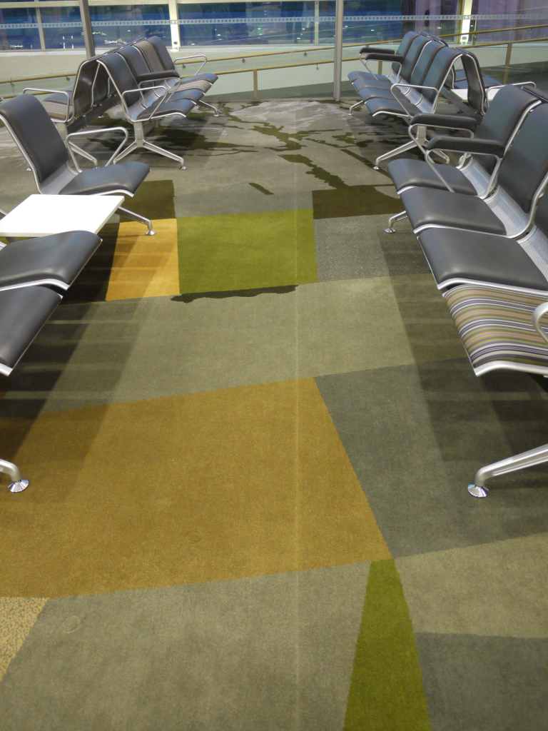
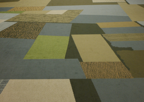
 Maps appear in the most unusual places. Our endless fascination with the patterns made by the natural and human landscape are often transferred to all manner of material and used for a wide range of purposes. I saw this example on a recent journey through Canterbury airport, New Zealand. As I wandered through the departure area I naturally thought the patterns on the carpet looked like a map then when you look at the vast expanse rolled out in front of you it becomes obvious it is a map. You are literally walking across a giant abstract map of the Canterbury Plains.
 The purpose was to provide visitors to the area with a lasting taste of South Island that mirrored the spectacular views of the Southern Alps from the lounge itself. The carpet has been designed to show the patchwork agricultural shapes of the plains juxtaposed with the rising mountainscape. Satellite imagery was used to re-create the landscape and the carpet is actually a fair representation of the region from Ashburton across the Alps.
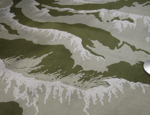 In a project such as this it’s as crucial to apply basic tenets of design and omission of extraneous detail such as river beds and buildings enabled the patchwork landscape to emerge. The large textured blocks of colour simulate different crop types to create a dramatic impression. Further, the earth tones actually creates a calming impression in an otherwise hectic environment. As the aircraft takes off you see the landscape for real.
 Not so much MapCarte as Map Carpet…with form, material and purpose that takes it beyond a simple artistic endeavour to one that genuinely had intent to create a cartographic experience. On a personal note…I was possibly the only person wandering the lounge taking copious photographs of the floor but I make no apology.
