
Our fascination with the Moon can be traced back to Galileo who, in the early 17th Century, started making maps of the surface using telescopes. In the mid-1650s, many others including the astronomer Giovnni Battista Riccioli also made maps and named many of the features, the names of which survive to today.
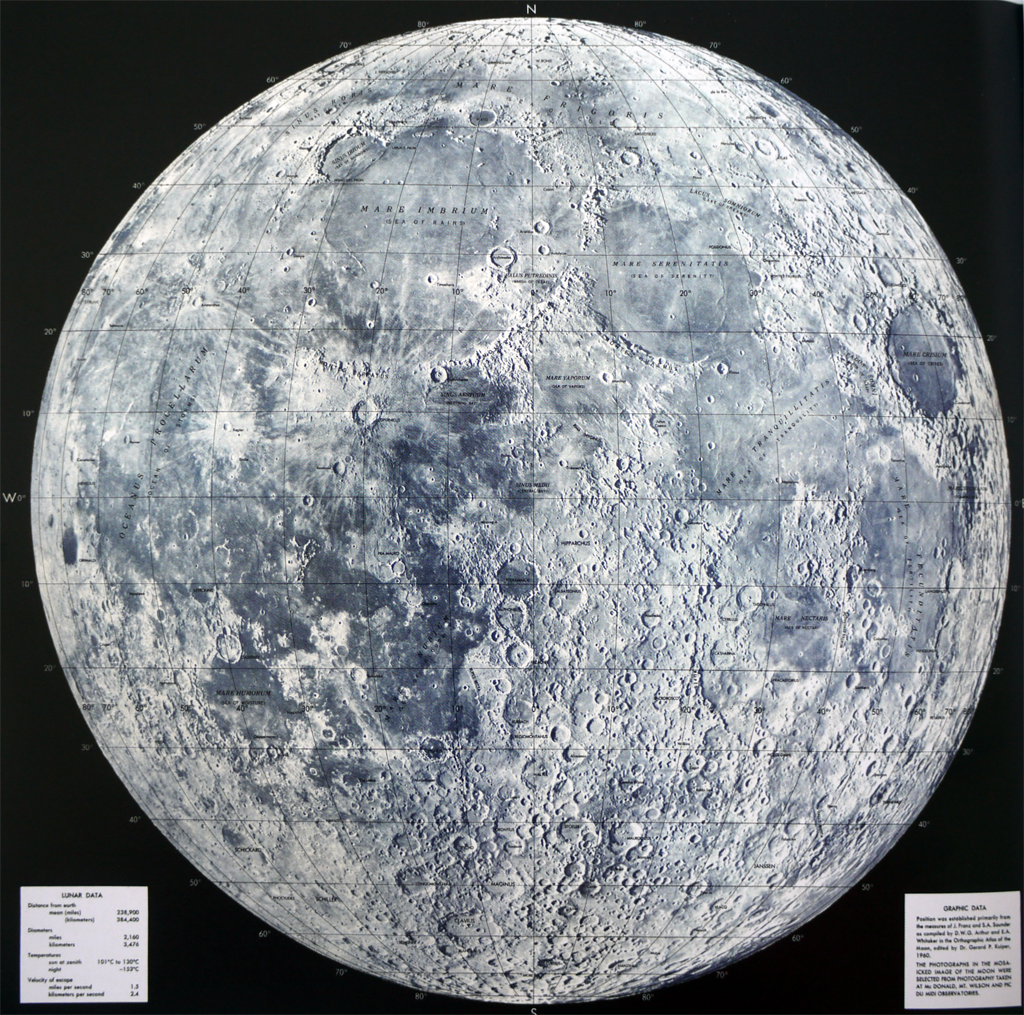
The use of unmanned space craft by NASA in the 1960s enabled far more detailed maps to be made. It’s Lunar Earthside Mosaic was a composite map created form many individual photographs. This version, at a scale of 1:2,500,000 used an orthographic projection and was used to plot Moon landings. Quite simply, it’s a beautifully detailed composite aerial photograph of the surface of the moon. The addition of labels that we’ve ascribed to the features gives it the appearance of being a little more inhabited than it is. It certainly helps us to characterise and converse about it in a way we couldn’t otherwise do.
Set against an inky black background, the simple blues and greys of the Moon stand out perfectly and the black typography is unobtrusive and uses thin line weights. A simple map created from a highly complex process.
