
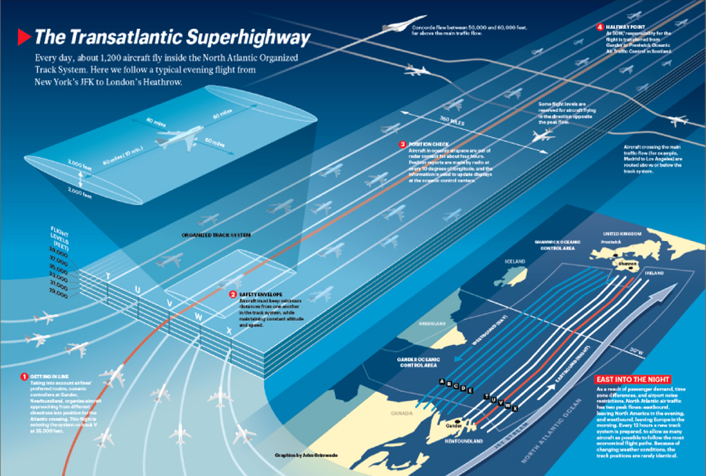
Abstract maps that take their subject and reproject into an imaginary space, distorting scale and reality can often bring clarity to a complex geography. Here, John Grimwade produces a map of the North Atlantic air traffic system for Condé Nast magazine. He visualizes routes as a linear strip map from North America to Europe showing scheduled flights at their safe distance and altitude.
There’s far more going on in this map than first inspection reveals which makes it perfectly in tune with our cognitive processes. For instance, the layout of routes from bottom left in the lighter areas to the top right, the darker areas actually mimics the latitudinal difference as well as the fact most west-east flights operate during the night. There’s a visual association that we subconsciously recognize. The safety envelope in the upper left gives us detail that we can then transpose to other flights. The individual detail works well as a key for the rest of the flights and, of course, not every flight is shown so we build our own associations.
Sadly, the map still lists Concorde as an operational flight given the map was published in 1996. Concorde was retired from service in 2003 to the great regret of many.
The map detail is highly generalised. Colours are in balance and sympathy and as a diagrammatic map used to tell a very simple story it works perfectly.
