
There’s very little that is genuinely new in cartography yet with such massive technological advances we see reinvention all the time. So it’s always useful to keep an eye on our cartographic heritage. It informs what we do because we can tease out best practice; and it shows us what has gone before so we can ensure we give credit where due.
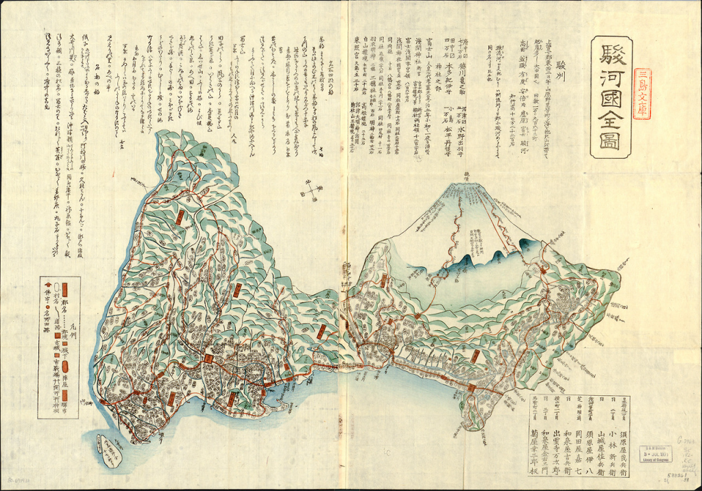
This stunningly beautiful map of Mt Fiji from the early 1800s gives us much food for thought. The detail of the mountainscape and, in particular, the use of a side elevation to create the appearance of molehills was used earlier but used here to great effect. The fact the Fuji itself is given prominence by being depicted in the round, rather than an elevation works well and shows how different graphical treatments to similar phenomena can be used to classify importance.
There’s a fine mix of planimetric and plan oblique in the work with a coastline shown using a vignette and some sense of routes across the landscape. The surrounding text works well in the traditional vertical orientation.
Overall, a beautiful historical map. Simple.
