
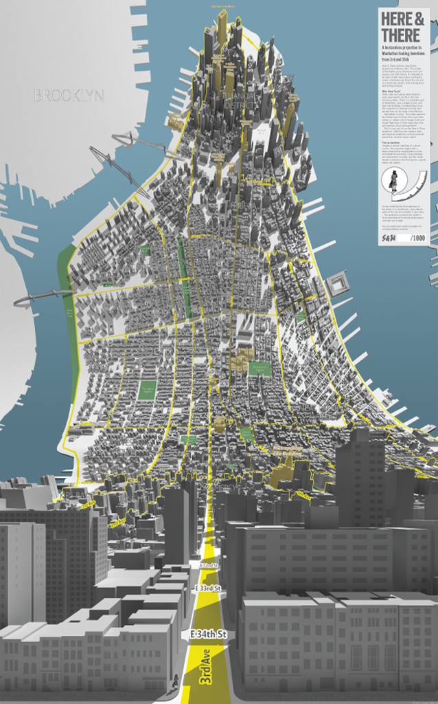
Created as a pair of maps of Manhattan, one looking uptown from 3rd and 7th and one looking downtown from 3rd and 35th, these fantastically curved maps are an exploration of the speculative projections of dense cities. Conceptually, they are an inverse of the more normal progressive projection that begins in the foreground with a planimetric map and then gently curves to the horizon to reveal an aspect.
The maps shows the viewer as a 3D person standing at the base of the map surrounded by large-scale local detail in perspective and bends to reveal the city stretched out ahead in plan view. It’s an intriguing and innovative way of representing an environment that would normally be out of sight and Shulze and Webb cleverly take design cues from Google’s map (grey buildings, yellow roads, haloed text) to give the map a sense of familiarity that juxtaposes the unfamiliarity of the warped view.
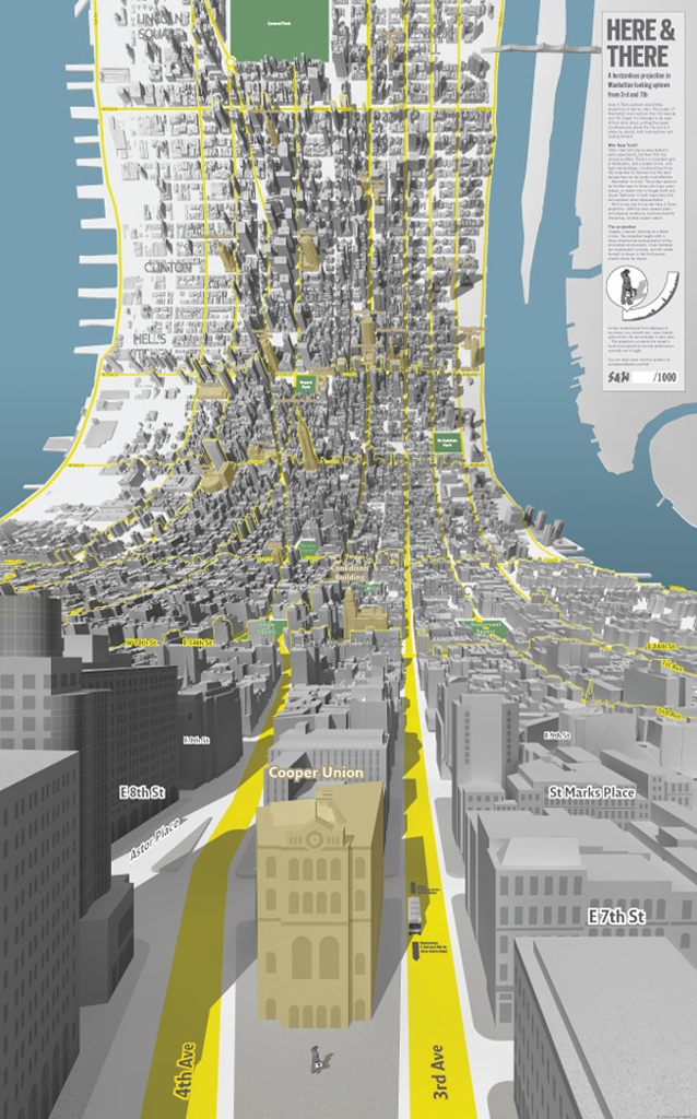
The gridded streetscape of New York lends itself well to this type of representation, as does the length of the island of Manhattan which creates a tall, narrow, large format poster that emphasizes the approach. A great re-imagination of geography and cartography that challenges us to think about not only place but the way in which we map it.
