

Hawaii
The Earth Resources Technology Satellites Program to launch satellites able to acquire remotely sensed images of Earth began in 1972 with the launch of what was to later become known as Landsat . April 2014 marks the 15th Anniversary of the launch of Landsat 7 and May 2013 saw the first data returned from the latest Landsat 8. Now managed by USGS in conjunction with NASA, the Landsat programme is the world’s longest running continuously acquired collection of space-based imagery of Earth. It’s imagery has revolutionised the way we view, explore, analyse, map and understand our world. It has provided an indispensable set of data to support agriculture, geology, planning, forestry and global change research.
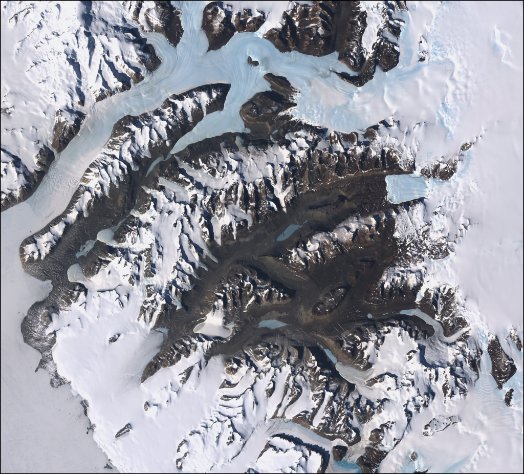
Dry valleys in Antarctica
The images and maps that have been made from Landsat data have given the world a new perspective. They’ve brought the beauty of the planet to popular media and the desktop. They’ve been uniquely informative in shedding light on our environment and how humans have reshaped it for better and worse. They enable us to better map and understand land use, land use change and help bring us discoveries that are only visible from space.

Mississippi River
While Landsat is only capable of capturing ‘data’, the way in which we interpret that and map it has given us some spectacular images of the earth. Remotely sensed images are, of course, a form of map. The resolution of each pixel is a generalised representation of the predominant land cover captured. Successful data processing and symbolisation can bring to light very specific features. In particular, false-color composites can be processed to a true-colour likeness as the leading image of Hawaii shows from the Enhanced thematic mapper (ETM+) instrument on Landsat 7. What the image captures is the beauty of Hawaii’s land cover that shows us hardened lava flows, volcanic smoke plumes, lush tropical forests, plantations and human settlement.

World Trade Center site in New York, September 12, 2001
Depending on the precise timing of the satellite orbit and data captured, Landsat has also brought us spectacular images of major events such as tornadoes, hurricanes, sandstorms and even the 9/11 attack on the World trade Center in New York. It has also shown us natural beauty such as the almost Van Gogh-like appearance of the swirling waters and plumes of phytoplankton around the Swedish island of Gotland.

Swedish island of Gotland takes on the appearance of Van Gogh’s ‘Starry Night’
This MapCarte entry cannot possibly do justice in describing the detail of the Landsat programme or showcase the many fine examples of maps and imagery it has underpinned. It is a masterpiece of technological innovation and design to overcome our need for acquiring remotely sensed data to support our mapping of the planet.
For more, check out the Landsat pages on the USGS web site here and view and download Landsat scenes here.

Pingback: MapCarte 335/365: World Trade Center site by Frank Culbertson, 2001 | Commission on Map Design