
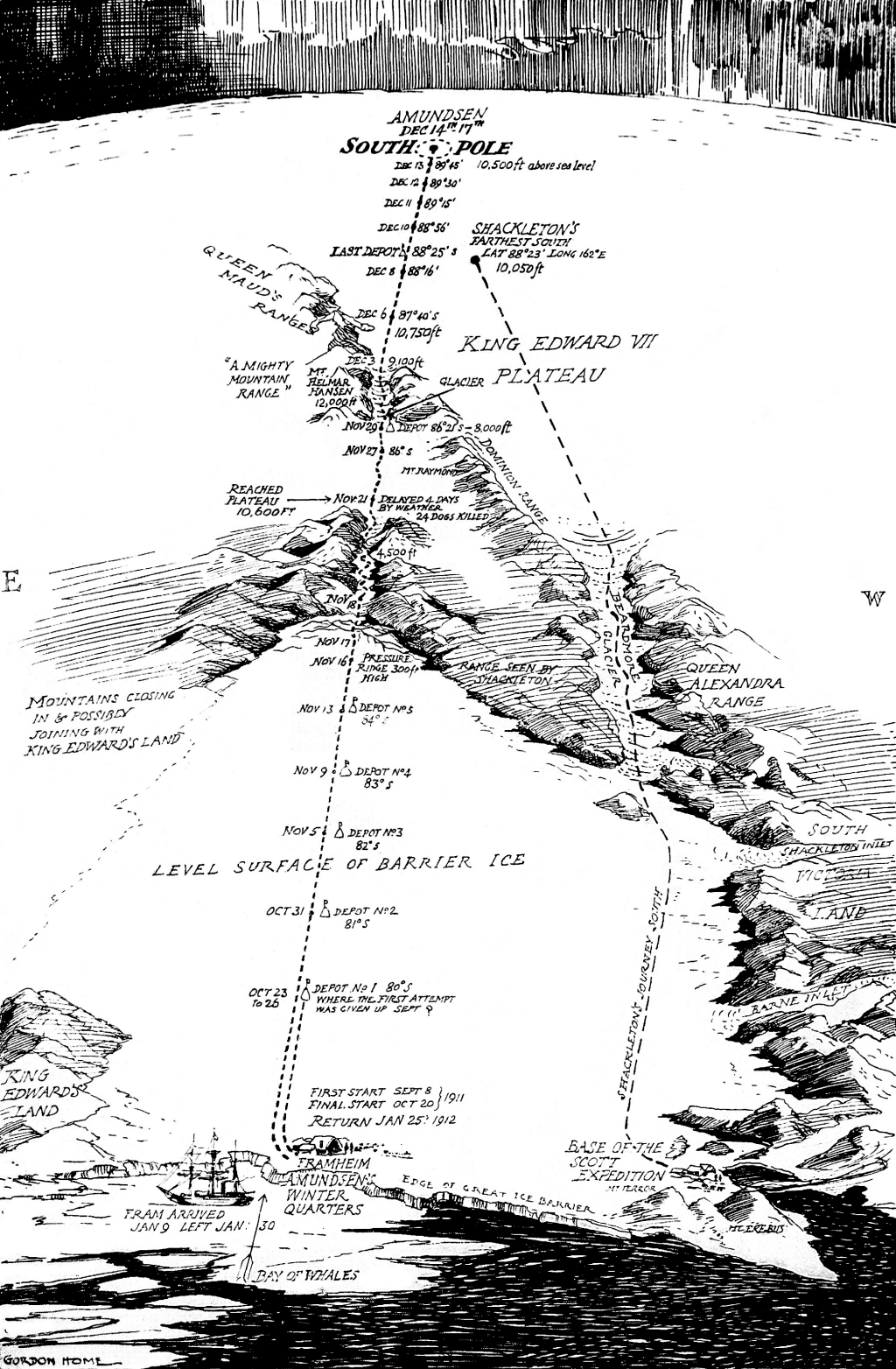
 The vast emptiness of Antarctica has long described as one of the last places on earth to be mapped. The maps produced around the time of the expeditions of Shackleton, Scott and Amundsen illustrated the stories, trials and tribulations of their famous treks to reach the South Pole. Most of the maps were not drawn by cartographers, but pieced together from journal entries by others. Here, Amundsen’s expedition is mapped by English landscape artist, writer and illustrator Gordon Home based on telegraph reports and which appeared in Amundsen’s own book of the expedition published after his return.
Home’s pen and ink drawing uses a grossly distorted perspective with a detailed foreground giving way to the mountain ranges, plateaus and empty open ice fields that were negotiated. Scale is inconsistent throughout but that’s an inevitable and immaterial consequence of this style of mapping. Curiously, the south pole is at the top but placed in the more normal orientation the map wouldn’t have looked right since the horizon would have been at the bottom. Home simply rotated the map to fit the need to create a linear route that plotted the journey from start to finish, bottom to top.
Using the map as a device to tell a simple linear story is well executed by Home. There’s actually very little by way of description and detail but that in itself gives the map a quality that allows the reader to imagine the severity of the challenge faced by the expedition teams. The foreboding blackened sky adds to the drama and sense of bleakness.
