
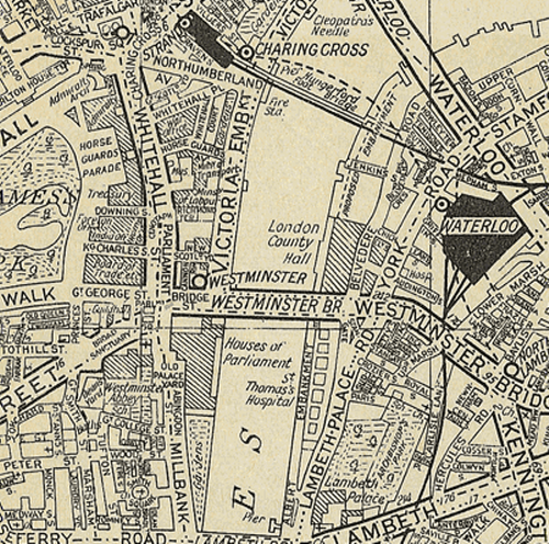
Phyllis Pearsall, a painter and writer, founded The Geographer’s Map Company in 1936 after discovering that the Ordnance Survey map she was following to get to a party wasn’t up to the task and she became lost. Her endeavors are possibly the first attempt to generate a citizen sourced map and might be seen as a forerunner to the OpenStreetmap movement and products.
She conceived the idea of mapping London which involved walking over 3,000 miles and over 23,000 streets mapping each as she went. Pearsall proofread, designed and drew the map with the help of a single draftsman. Although a map containing hundreds of combinations of type form: bold, italics, spacing of characters, color, san serif, reversed type, size, rotation, upper and lower case, the design and placement of the typography is meticulous.
In the modern version, the use of orange primary routes, yellow secondary and white local was unique and possibly the inspiration for Google Maps at street level. The pocket book size of the original was a perfect form for navigation and despite the atlas being crammed with detail it is extremely well structured in graphical terms.
