
Our mental maps of the world can be impacted by knowledge, experience and our sense of what and where is important to us as individuals. It’s no wonder, then, that our own personal maps are heavily distorted and reflect a warped geography often exaggerating the familiar and ignoring places and detail that are irrelevant to us. When drawn, we often see bizarre landscapes emerge.
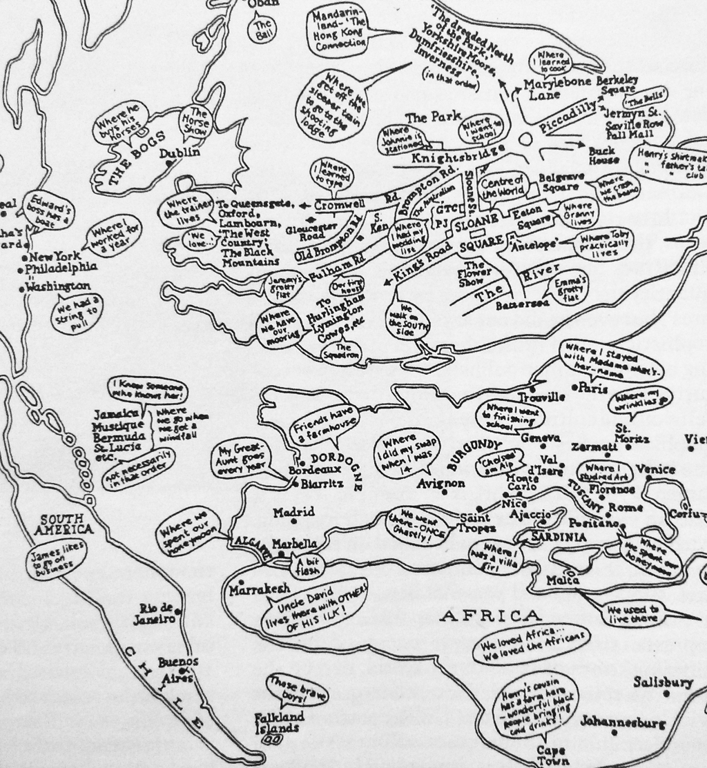
Here, a comical take on the mental map of what is important to the individual from ‘Sloane Rangerland’. The shapes of countries are hugely distorted. There’s a focus not only on England but also a wildly exaggerated road network comprising of the important roads around Sloane Square, London. Only the important towns and cities are located with no real sense of hierarchy yet the map works. Its annotations (as speech bubbles) narrate the landscape and demonstrate that hugely personal maps can be successful in communicating a very specific theme.
This map also illustrates the value of mapping in black and white. Colour can often complicate a map so if it’s unnecessary then consider monochrome – it certainly focuses the design thinking.
