
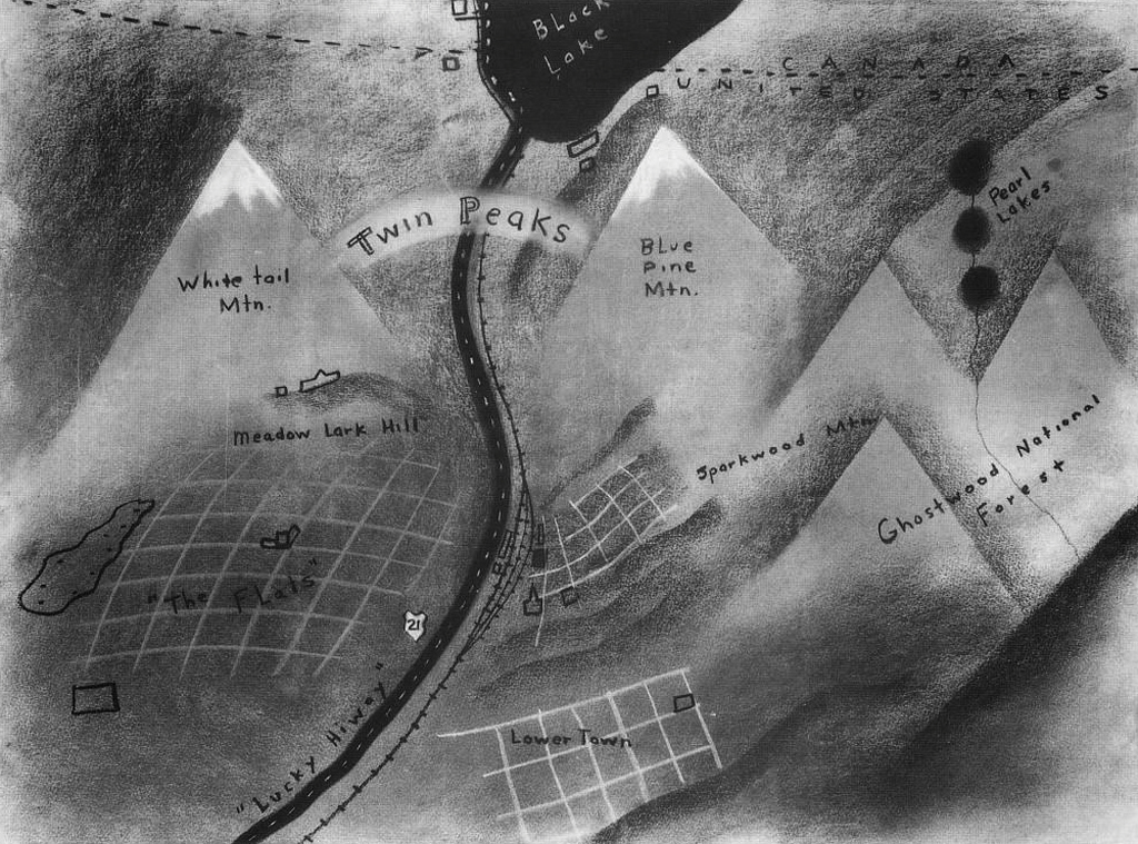
Fictional cartography expertly created by director David Lynch who presented this map to potential television producers as a way of giving a sense of place to his fictional place (and programme) Twin Peaks. rather than present scripts, lynch drew the map to give an idea of where the action was to take place with White Tail and Blue Pine mountains clearly shown as a key feature in the landscape.
The town becomes more believable as a map. The monochrome presentation gives a sense of quirkiness, darkness and intrigue as well as creating something more interesting than a simple planimetric, abstract version. This reflects the stories to be told and creates a ‘mood’ and an emotional reaction in the map reader. The map sacrifices accuracy for detail which enhances the elements of the landscape that are relevant to the story. The sense of the all_american small town that harbours bone-chilling evil are well captured in Lynch’s treatment.
