
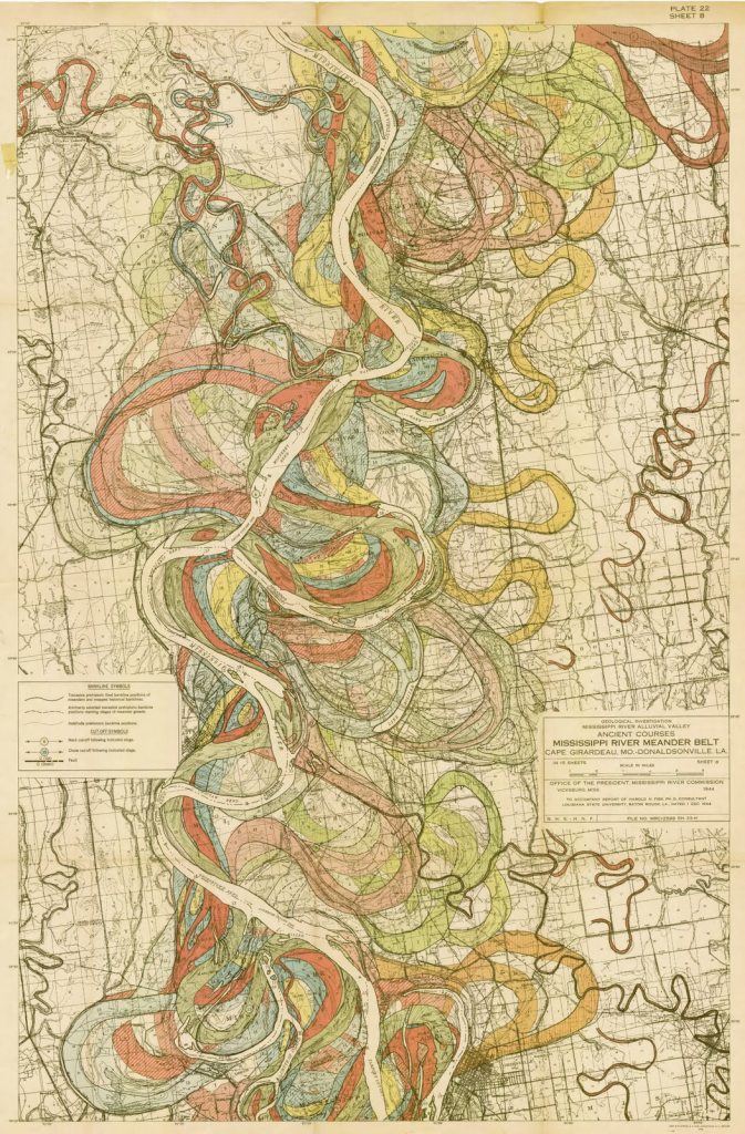
In 1941, the Mississippi River Commission appointed Harold Fisk to undertake a geological survey of the Lower Mississippi Valley. His detailed and exhaustive report contained 15 maps that illustrated the historical courses of the river, colour coded for different ages of point bar migration, chute cut-offs, and avulsions.
As a collection they succinctly present the complicated story of channel evolution of the river and are archived by the US Army Corps of Engineers (download here). Rather than attempting to fit all detail on one map, Fisk let the geography drive the size and scale necessary to show detail clearly. The maps exhibit a perfect blend of neutral basemap to provide a context for the coloured detail of the river morphology though almost every colour has a percentage of black to allow it to tone harmoniously with the grey background.
The organic historical stream flow patterns make an intriguing visual and despite the fluidity of the mapped phenomena the maps appear very structured.

Pingback: Indeterminate Rivers – Hidden Hydrology