
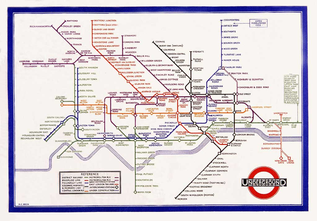
A predictable start for the MapCarte series but let’s get it out the way…my personal favourite. A schematic diagram was Beck’s solution by which to map the London underground for navigation. It’s a simplified and heavily generalised map consisting of stations, colour-coded straight line segments which run vertically, horizontally or at 45 degree diagonals. Ordinary stations are differentiated from interchanges; the central area is exaggerated and external areas contracted. The map shows no relationship to above ground geography other than the River Thames. The same approach is still in use today by Transport for London, though the map has gone through countless revisions and design changes the core characteristics remain. Beauty in simplicity and a model for many transport related maps to this day.

Hello Ken,
Can’t go wrong with Harry Beck as the first entry of course… But I really think you should include larger versions of the maps you are going to highlight in your MapCarte series. To appreciate this map I really need a version larger then 500 × 349 pixels. Or at least include a link to a higher res version somewhere…
Yours,
Barend Köbben
Thanks Barend. Have added this for MapCarte 1/365 and will do so for as many as possible.
Pingback: MapCarte 273/365: Highways of the United States of America by Cameron Booth, 2014 | Commission on Map Design